Greece › Athens › Tourist Maps
Updated: January 13, 2026 • By Santorini Dave
Questions? dave@santorinidave.com
Athens Maps – My Tips
- 1. Download Offline Google Maps Before You Arrive
Do this over Wi-Fi before leaving home. It ensures navigation works even with spotty signal in Plaka’s narrow alleys. Open the app, tap your profile icon (top right), select Offline maps, and zoom out to include the city center, Athens Airport (ATH), and Piraeus Port. I also recommend you “Star” (save) your hotel and the Acropolis so they are instantly visible on the map.- 2. Learn the “Big Three” Squares
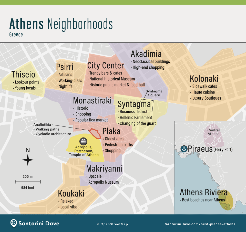
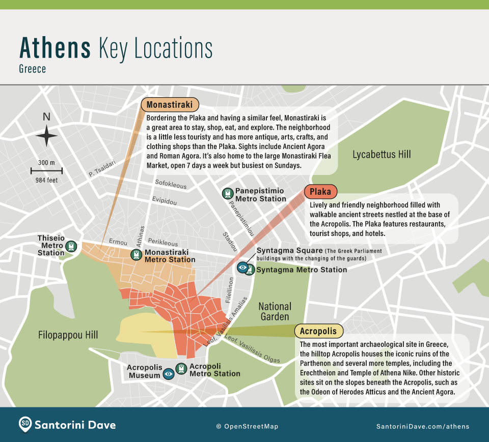
Use these three squares as anchors to orient yourself. Syntagma Square is the transport and political heart (Parliament). Monastiraki Square is the historic market hub next to Plaka. Omonia Square is the major commercial intersection to the north.- 3. Walk the “Historic Triangle”
Most first-time sights lie within the triangle formed by Syntagma, Monastiraki, and the Acropolis. If your map shows you are within this zone, you are within walking distance of Plaka, Psiri, the Roman Agora, and shopping on Ermou Street.- 4. Master the 3 Key Metro Stations
Historic Athens is largely pedestrian-only but is ringed by three essential stations. Syntagma (Lines 2 & 3) and Monastiraki (Lines 1 & 3) both now offer direct connections to the Airport and Piraeus Port. Acropoli (Line 2) is the best stop for the Acropolis Museum and the south slope entrance to the Parthenon.

Where to Stay in Athens
My Favorite Hotels in Athens
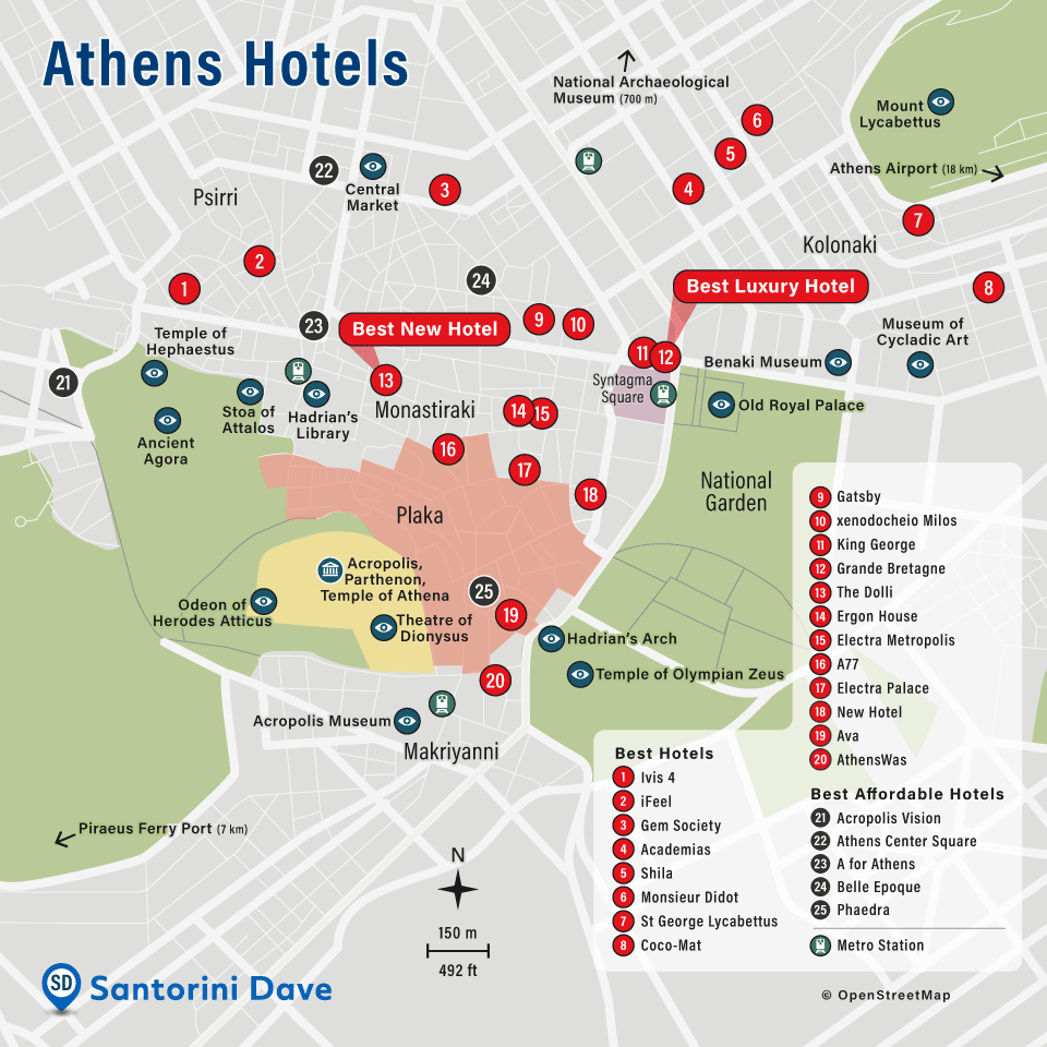
Best Hotels:
1. Ivis 4 • 2. iFeel • 3. Gem Society • 4. Academias • 5. Shila • 6. Monsieur Didot • 7. St George Lycabettus • 8. Coco-Mat • 9. Gatsby • 10. xenodocheio Milos • 11. King George • 12. Grande Bretagne • 13. The Dolli • 14. Ergon House • 15. Electra Metropolis • 16. A77 • 17. Electra Palace • 18. New Hotel • 19. Ava • 20. AthensWas
Affordable Hotels:
21. Acropolis Vision • 22. Athens Center Square • 23. A for Athens • 24. Belle Epoque • 25. Phaedra
Athens Attractions
Places to Know in Athens
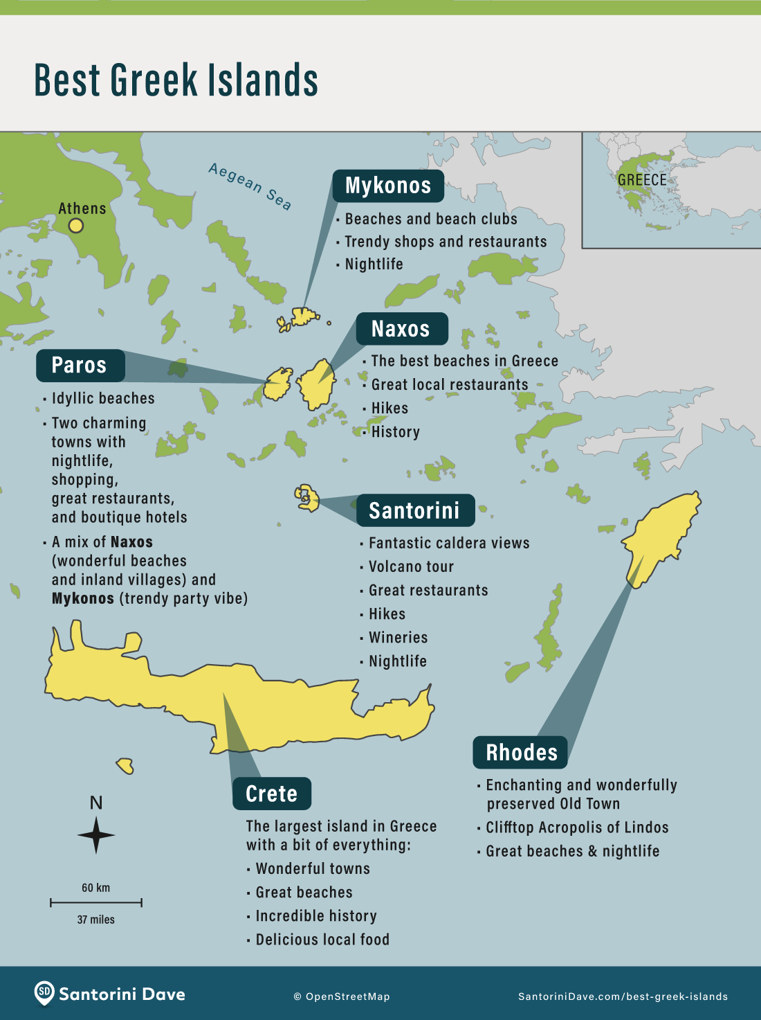
The Best Greek Islands near Athens
Where to Stay in Athens
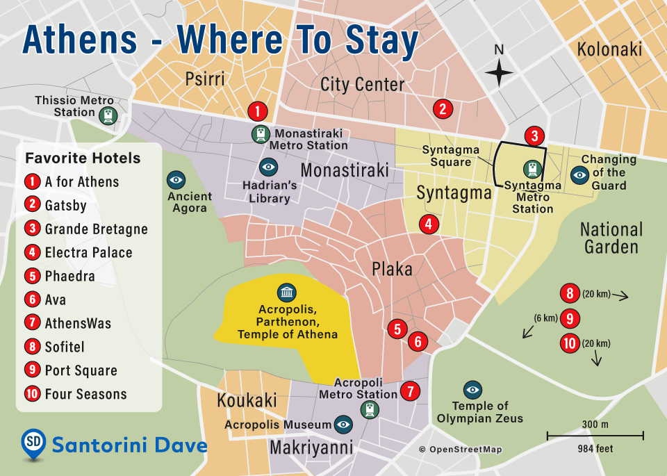
1. A for Athens • 2. Gatsby • 3. Grande Bretagne • 4. Electra Palace • 5. Phaedra • 6. Ava • 7. AthensWas • 8. Sofitel (Airport) • 9. Port Square (Ferry Port) • 10. Four Seasons (Athens Riviera)
Athens Transportation Maps
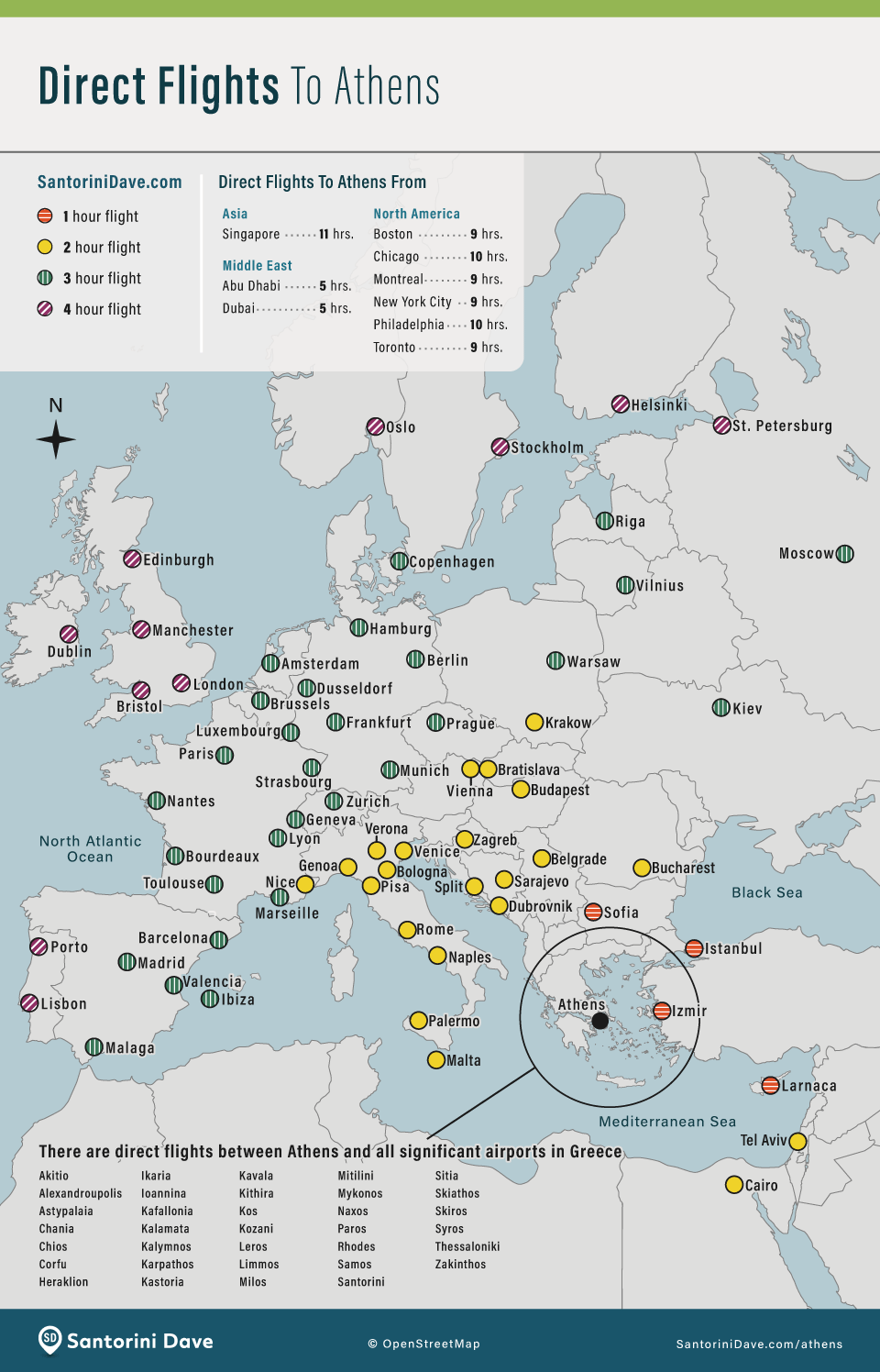
Direct Flights to Athens
Athens Airport Map
Hotel at Athens Airport: Sofitel Athens Airport
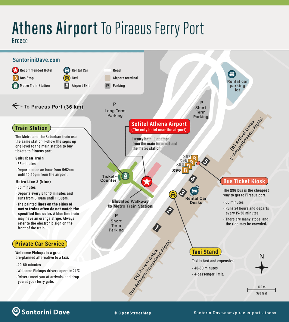
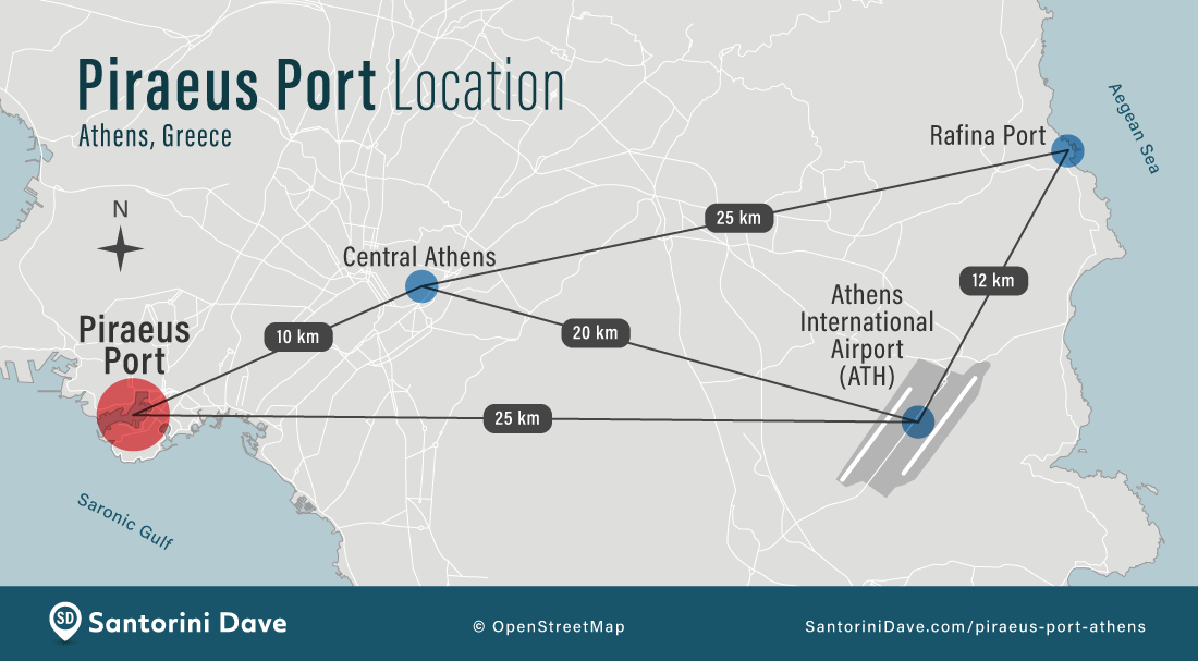
Athens, Ferry Ports, and Airport Location
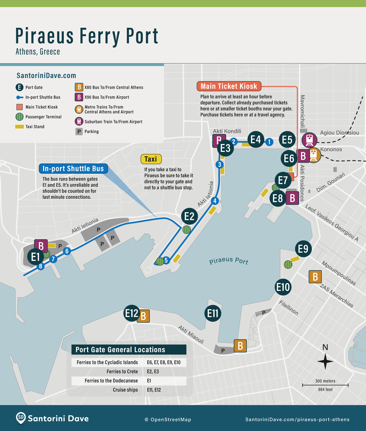
Piraeus Ferry Port
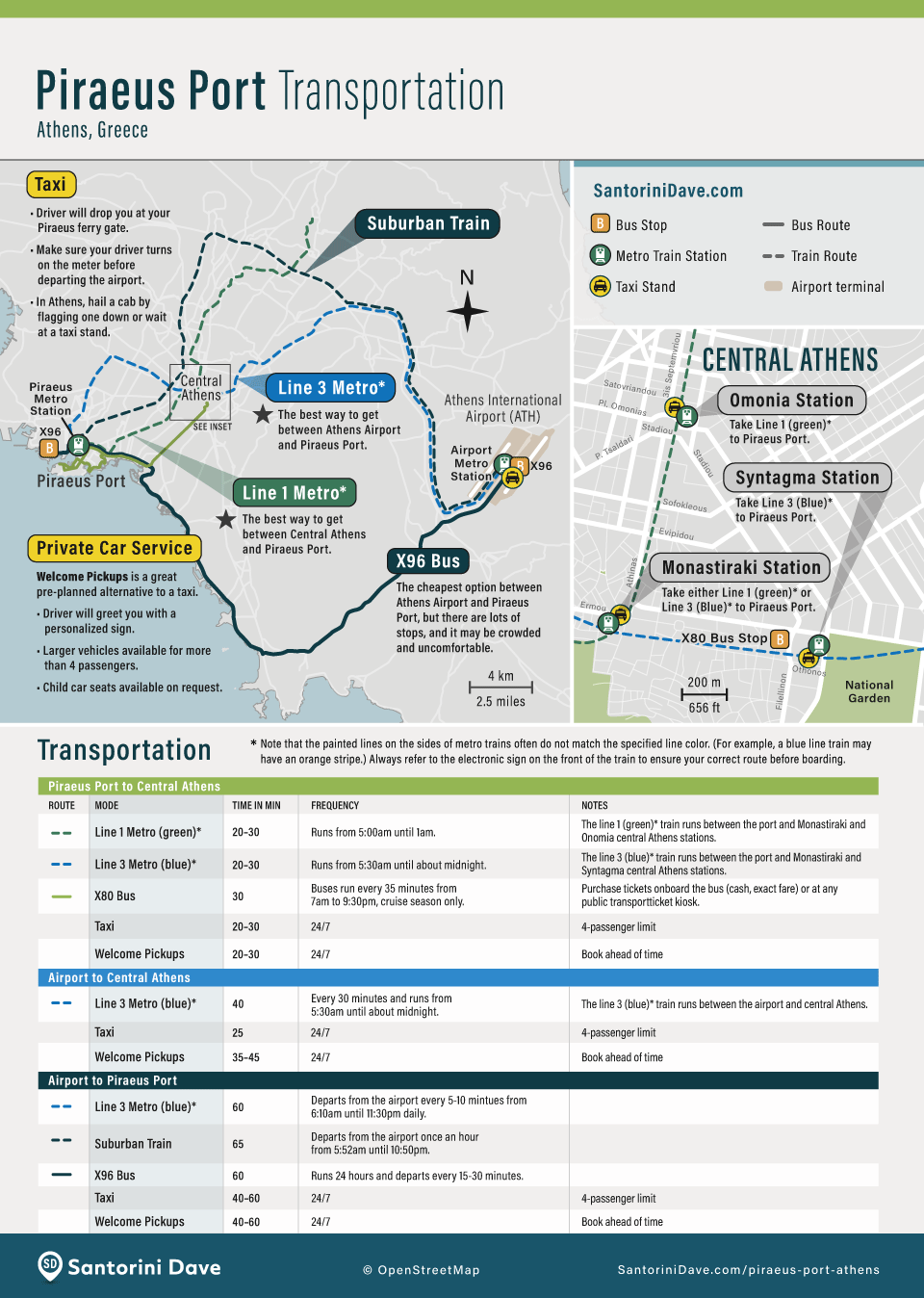
Airport-Ferry Port Transportation
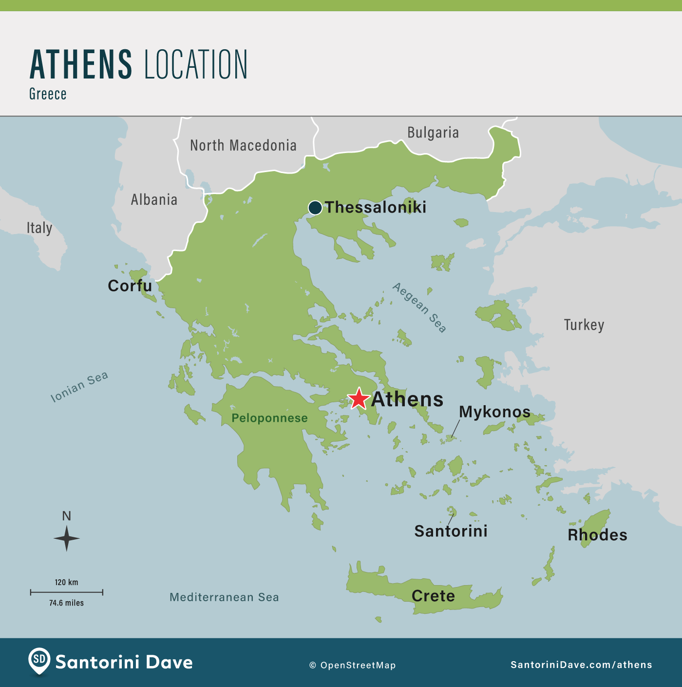
Where is Athens, Greece?

About Santorini Dave