Greece › Paros › Tourist Maps
By Santorini Dave
Paros is a compact Cycladic island with Parikia and the main ferry port on the west coast, Naoussa in the north, Lefkes in the mountainous interior, and many of the best beaches along the east and south coasts. Parikia and Naoussa are the two main towns, while Aliki, Piso Livadi, Logaras, and Golden Beach are good bases around the quieter south and east coasts. Parikia to Naoussa is about a 20-minute drive, and crossing most of the island takes 30 to 40 minutes. Paros Airport is south of Parikia, while idyllic Antiparos sits just off the southwest coast and is reached by a short ferry from Pounta. When driving, stick to the main paved roads, as Google Maps sometimes suggests rough tracks and walking routes as shortcuts through the interior.
Paros Maps: Towns, Beaches, Hotels & Transportation
Map of Where to Stay in Paros
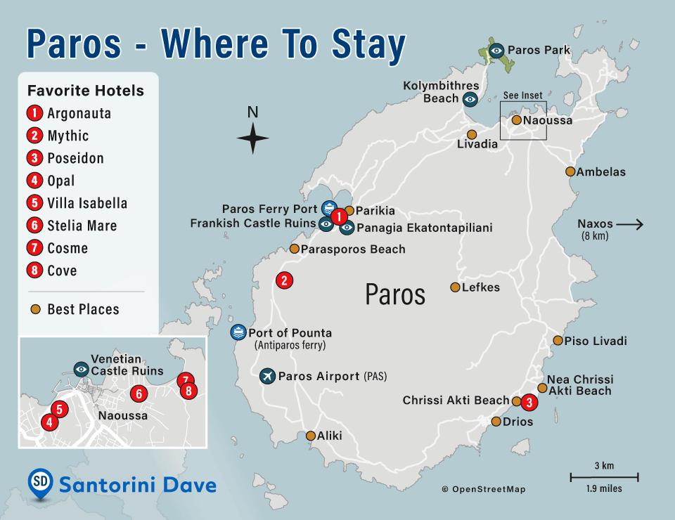
1. Argonauta • 2. Mythic • 3. Poseidon • 4. Opal • 5. Villa Isabella • 6. Stelia Mare • 7. Cosme • 8. Cove
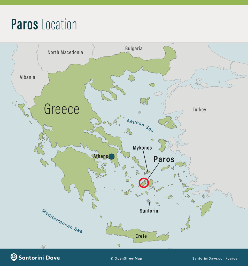
Where is Paros?
Main Towns and Beaches in Paros
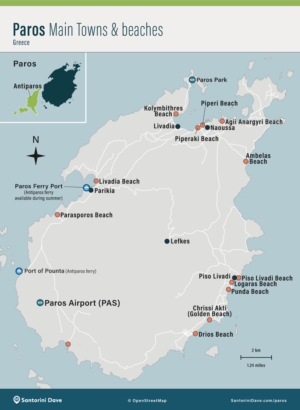
Naoussa is my favorite base for restaurants, nightlife, and atmosphere; Parikia is best for ferry convenience and a wider range of hotels; Piso Livadi and Logaras are quieter and good for beaches; and Golden Beach is best for swimming and watersports. A rental car makes the quieter parts of Paros much easier to explore.
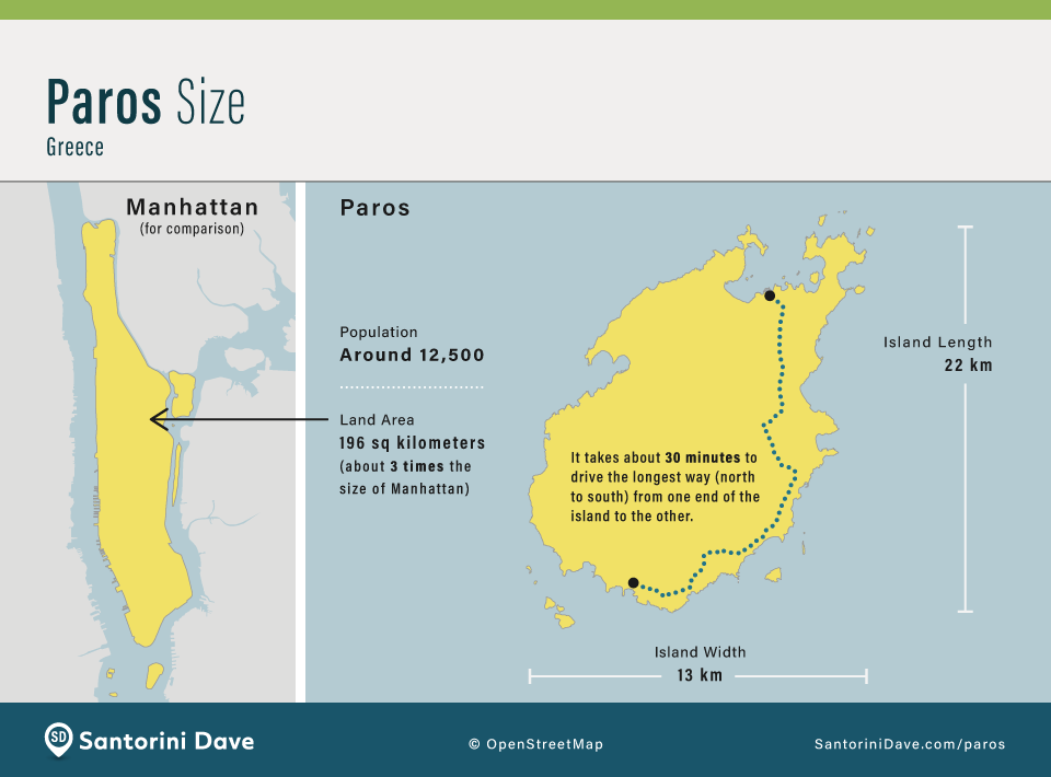
Paros Relative Size
Paros Beaches & Things to Do Maps
Map of Paros Beaches
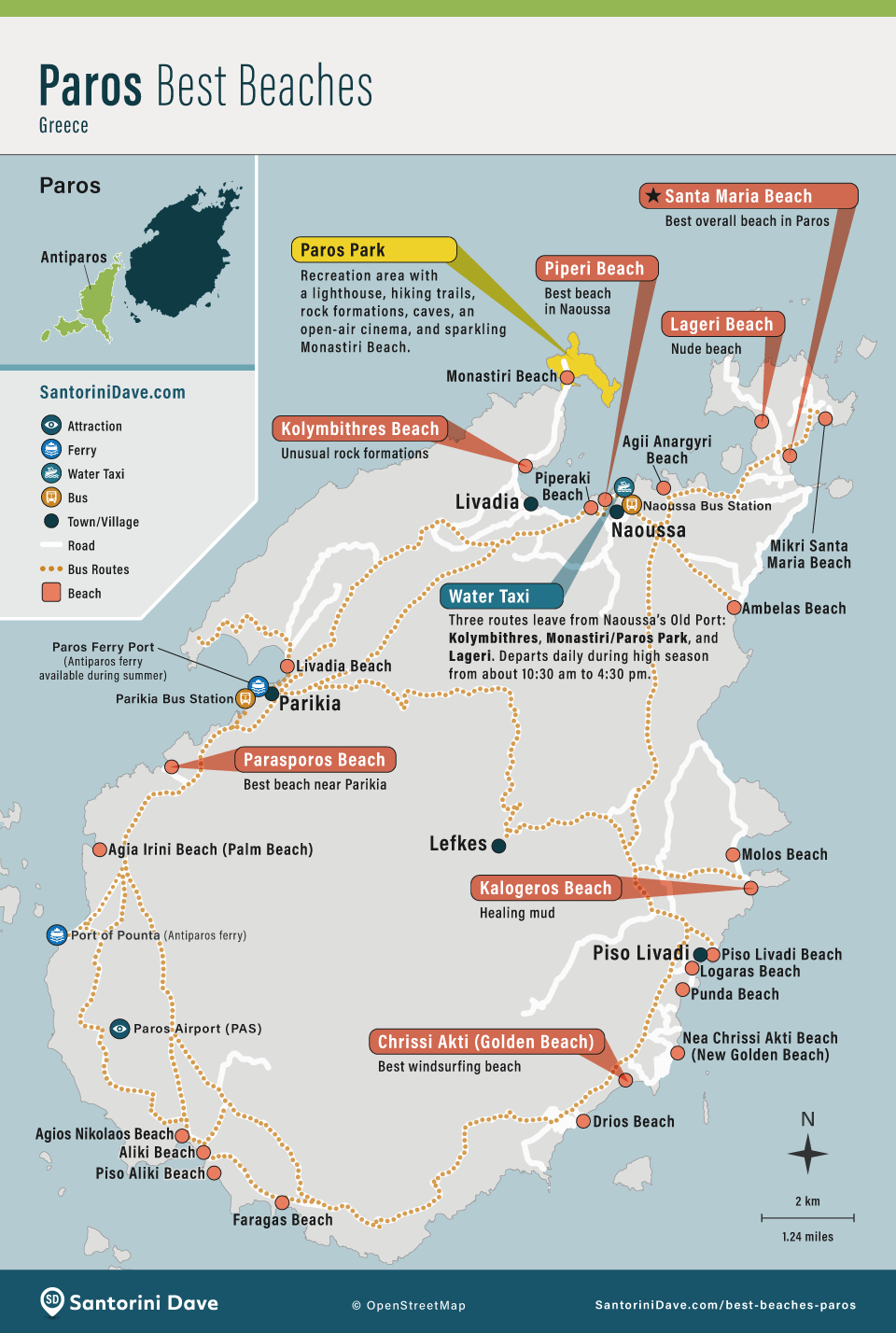
Most of Paros’s best swimming beaches are on the north, east, and south coasts. Kolymbithres is the standout near Naoussa; Golden Beach (Chrissi Akti) and New Golden Beach are best for watersports and among the best areas for families; and Faragas is one of my favorites on the south coast.

About Santorini Dave