Greece › Mykonos › Maps
Updated: August 11, 2026 • By Santorini Dave
See Also
Map of Mykonos Main Towns & Beaches
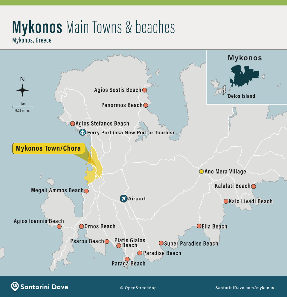
Mykonos Maps: My Tips
- Download an offline map before exploring Mykonos Town. Chora is a maze of narrow pedestrian lanes, and it is very easy to lose your sense of direction. Download Mykonos for offline use in Google Maps and save your hotel, Fabrika, the Old Port, and any restaurants or beaches you plan to visit.
- Use three landmarks to orient yourself in Mykonos Town. The Old Port is on the north side of the center, Fabrika Bus Station is to the south, and the windmills and Little Venice are on the western waterfront. Most of the pedestrian shopping, restaurants, bars, and lanes are between them.
- Know which bus station you need. Fabrika serves most south and southwest beach routes, including Ornos, Agios Ioannis, Platis Gialos, Paraga, and Paradise. The Old Port bus station serves routes including Ano Mera and other northern and eastern parts of the island. Routes and frequencies change through the season, so check the current timetable before setting out.
- The Old Port and New Port are different places. Ferries use the New Port at Tourlos, about 2 km north of Mykonos Town. The Old Port is beside the center of town and is used for boat tours and trips to Delos. The SeaBus is one of the easiest ways to travel between Mykonos Town (Old Port) and the New Port.
- Do not judge walkability by distance alone. Distances on Mykonos look short, but hills, busy roads, and missing sidewalks make some routes unpleasant or unsafe on foot, especially after dark. Mykonos Town, Ornos, and Platis Gialos are the easiest bases for travelers who do not want to rely heavily on taxis or a rental car.

Map of Where to Stay in Mykonos
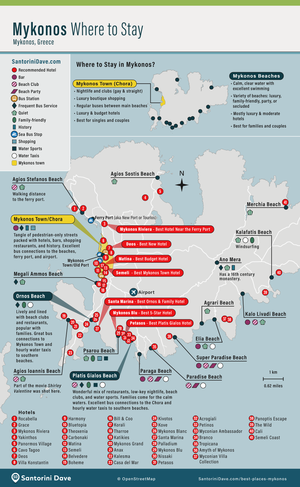
My favorite areas for most first-time visitors are Mykonos Town for restaurants, nightlife, and convenience; Ornos for an easy beach base with good connections; and Platis Gialos for one of the best combinations of beach, hotels, restaurants, buses, and water taxis. See my complete guide to where to stay in Mykonos for hotel recommendations in each area.
Map of Mykonos Town
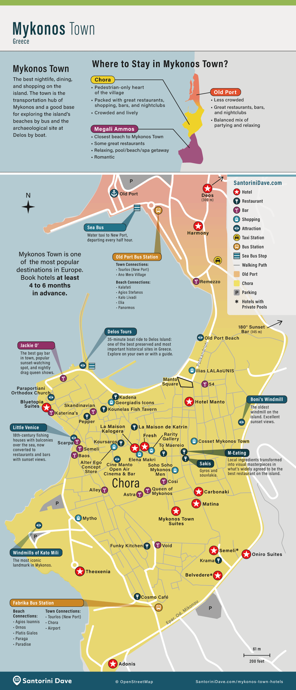
Mykonos Town is compact and best explored on foot. Cars are of little use in the pedestrian center, so hotel location matters most when you are arriving with luggage or walking to buses, taxis, and the SeaBus.
Map of Mykonos Location in Greece
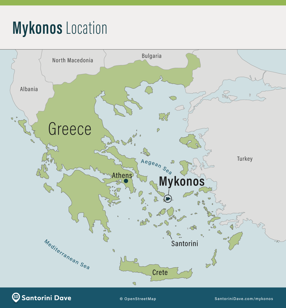
Map of Mykonos Relative Size
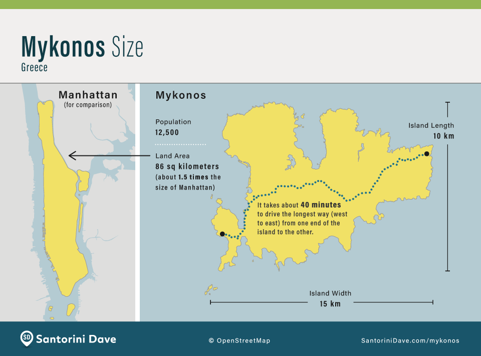
Mykonos is a small island, but travel times can be longer than the map suggests because most roads are narrow and indirect. Staying in the right area matters more than being a few kilometers closer to a particular beach.
Mykonos Hotel Maps
Map of the Best Hotels in Mykonos
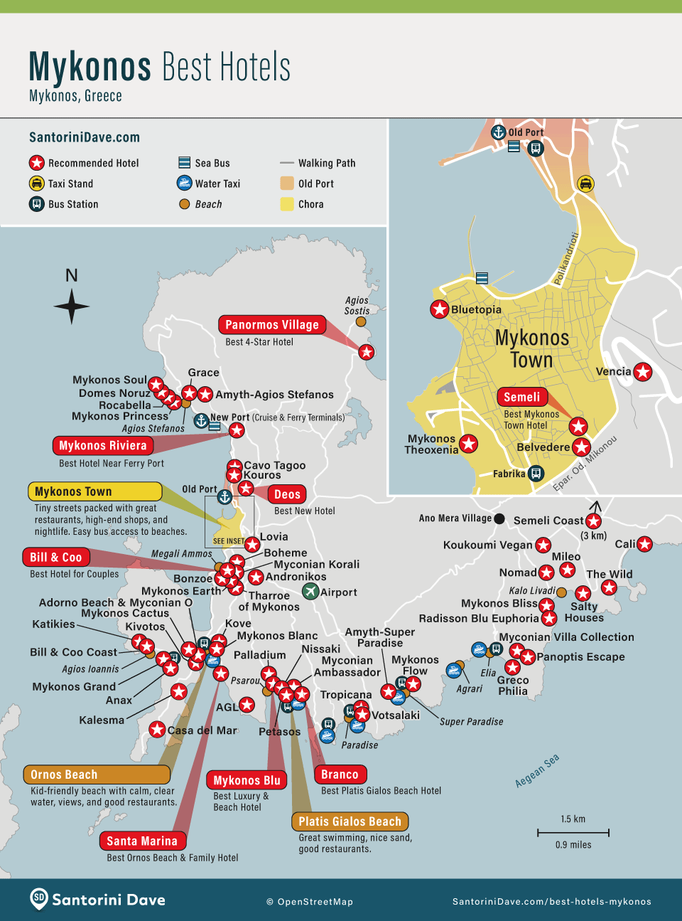
The strongest hotel areas are clustered around Mykonos Town and the south and southwest coast, but there are excellent resorts in quieter parts of the island too. See my Best Hotels in Mykonos guide for my complete hotel rankings.
Map of the Cheap Hotels in Mykonos
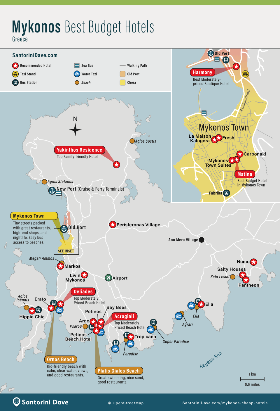
Mykonos is expensive, but good-value hotels are spread around Mykonos Town, Ornos, Platis Gialos, and several less central areas. Location matters: a cheaper hotel that requires frequent taxis can quickly stop being a bargain.
Map of Mykonos Beaches
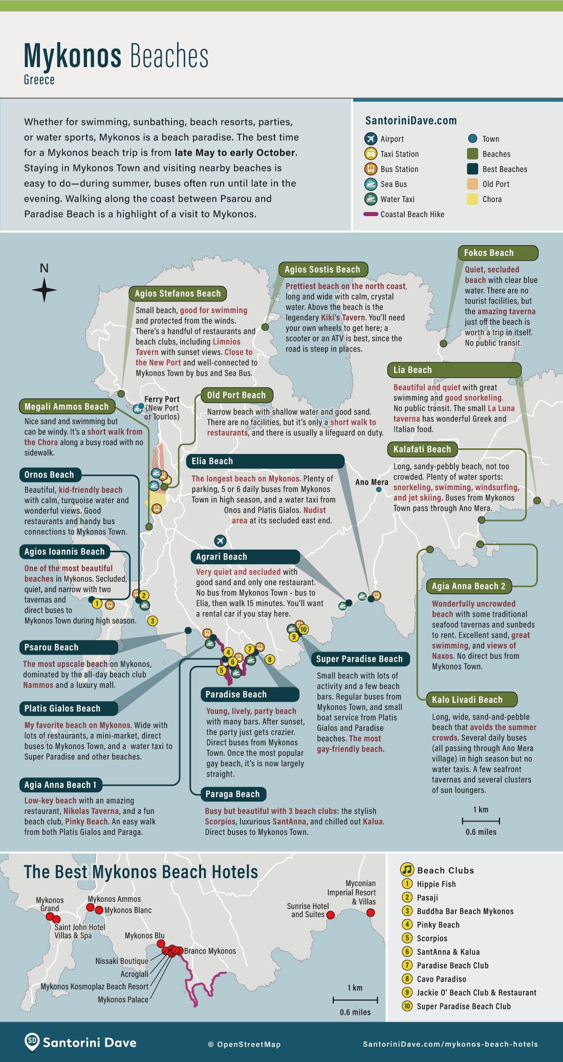
Most of the best-known beaches are along the south coast, where there is less exposure to the strong northern winds. Ornos and Platis Gialos are best for convenience and families; Paradise and Super Paradise are the best-known party beaches; Elia is long, attractive, and farther from Mykonos Town.
Mykonos Water Taxi Map
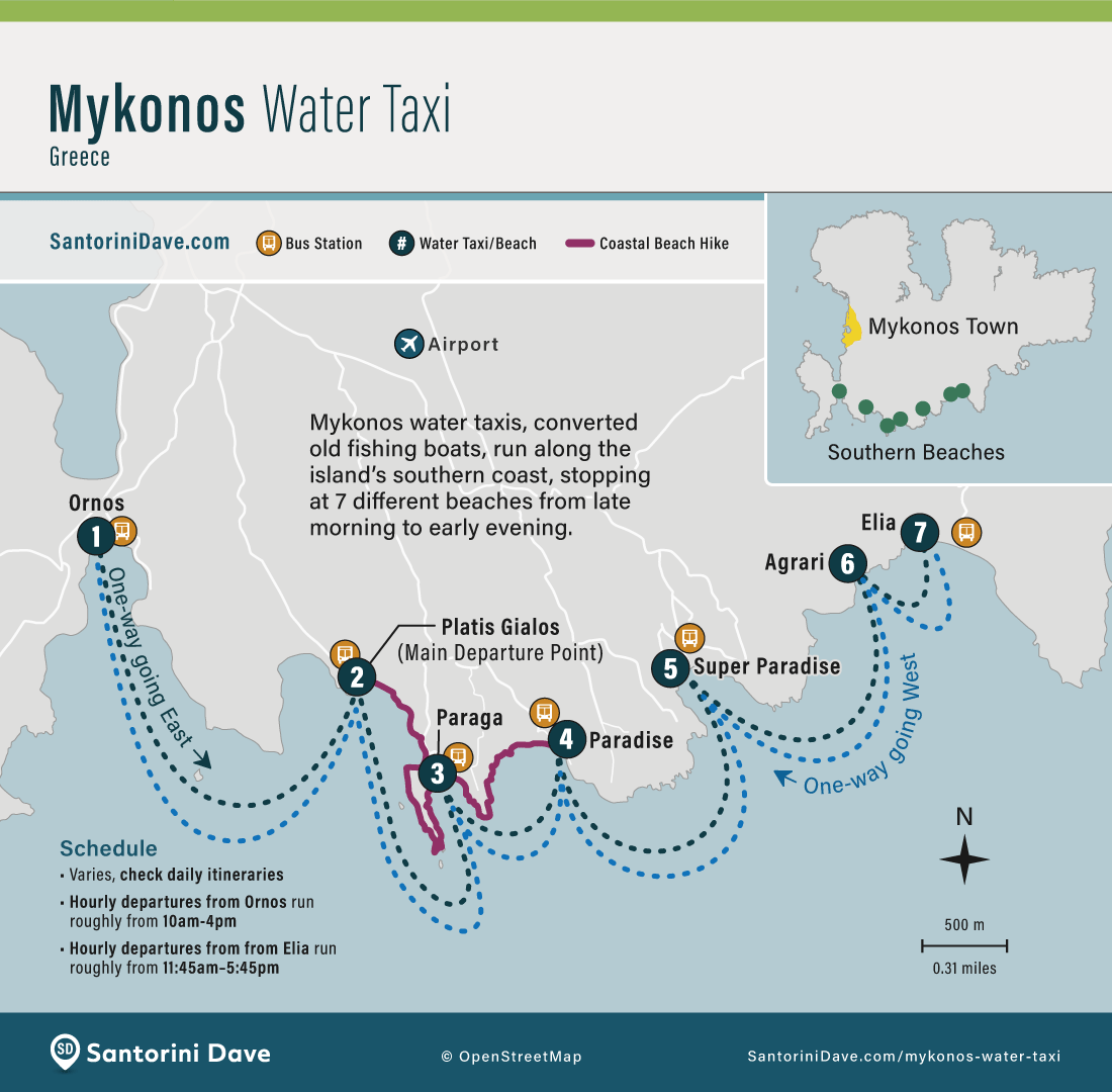
The water taxi connects several south-coast beaches and is one of the easiest and most enjoyable ways to beach-hop. It is different from the SeaBus, which connects Mykonos Town with the New Port at Tourlos.
Map of Mykonos Best Beach Walk
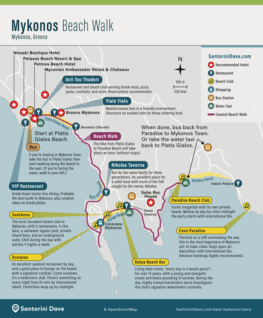
One of my favorite walks on Mykonos follows the coast from Platis Gialos through Agia Anna and Paraga to Paradise Beach. It is an easy way to combine several beaches without a car.
Map of Mykonos Bars & Clubs
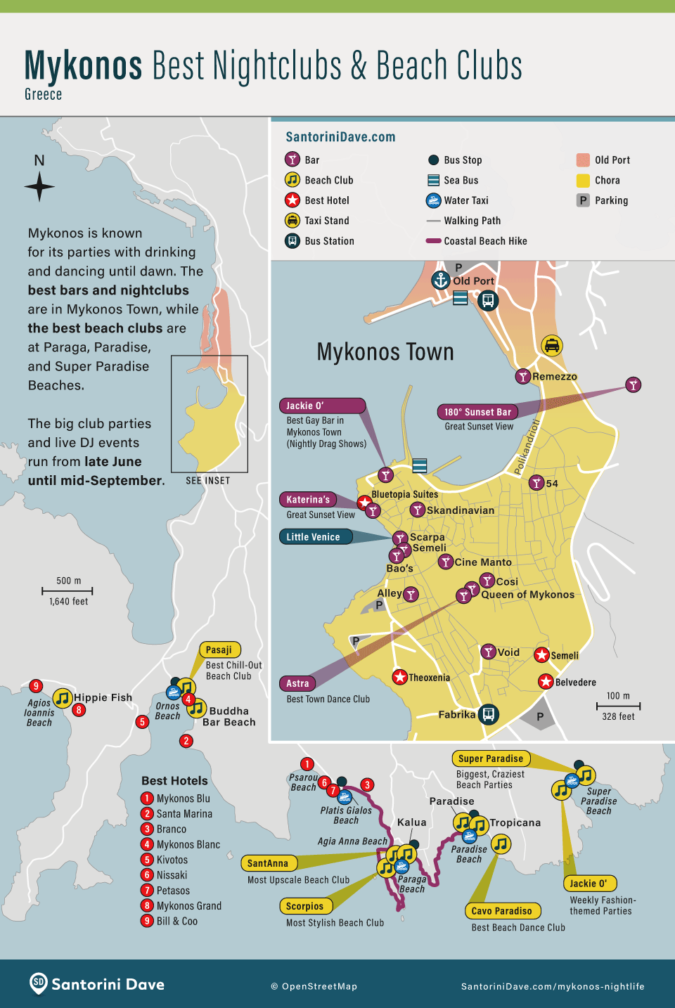
Most bars and late-night clubs are concentrated in Mykonos Town, while the biggest beach-party venues are along the south coast. Staying in town is the easiest choice if nightlife is a priority and you do not want to arrange late-night transportation.

About Santorini Dave