Greece › Greece Map
Updated: January 13, 2026 • By Santorini Dave
Questions? dave@santorinidave.com
See Also
- Greece Travel Guide
- Santorini Travel Guide
- Mykonos Travel Guide
- Crete Travel Guide
- Naxos Travel Guide
- Paros Travel Guide
- Athens Travel Guide
Greece Maps – My Tips
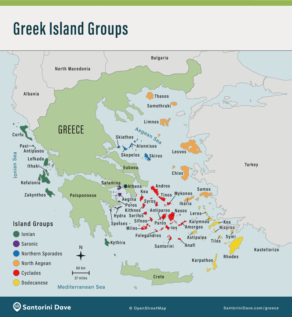
- 1. Understand the Island Groups
Greece has 6 main island groups, and they don’t all connect easily. The Cyclades (Santorini, Mykonos, Naxos) are the most popular and have the best ferry connections. The Ionian Islands (Corfu, Zakynthos) are in the west and distinct from the Aegean islands. Key rule: Ferries generally run north-south within a group, not east-west between groups. Travelling from the Ionian side to the Aegean side usually requires a flight or a long bus ride via Athens.- 2. Athens is the Hub
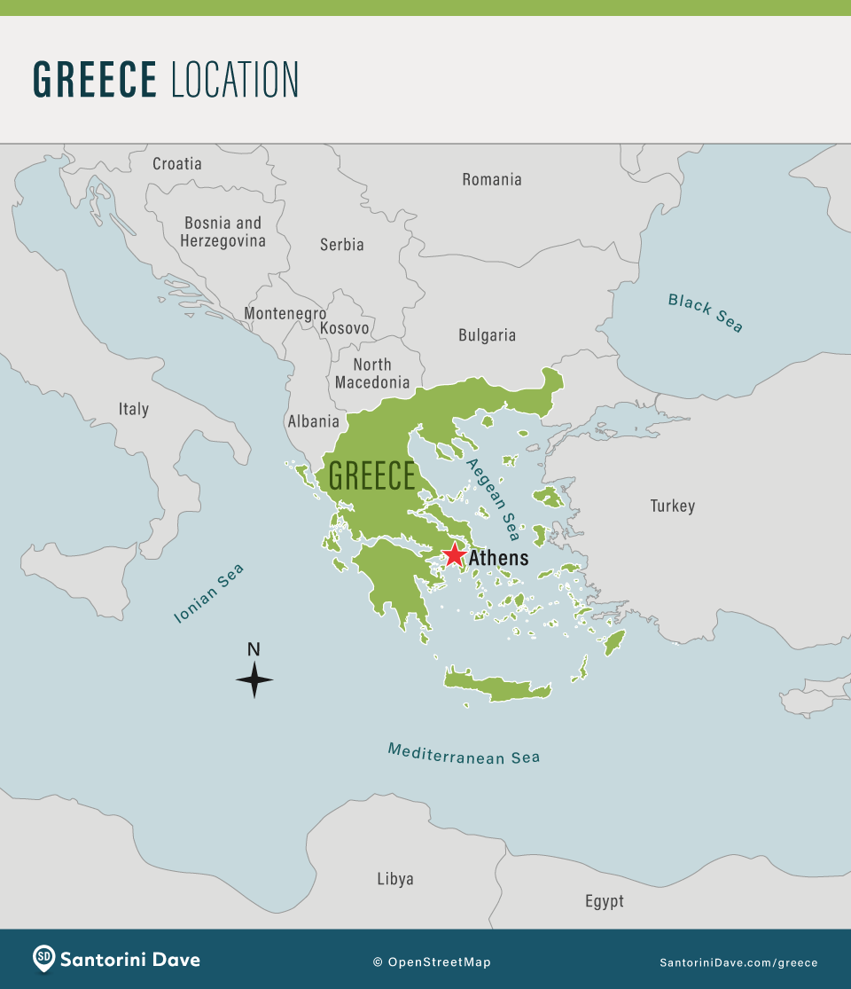
Almost all travel in Greece radiates from Athens. It’s home to the main airport (ATH) and the main ferry port (Piraeus). If you are visiting multiple island groups or mixing the mainland with islands, you will likely pass through Athens more than once. Use it as your pivot point.- 3. Don’t Ignore the Mainland
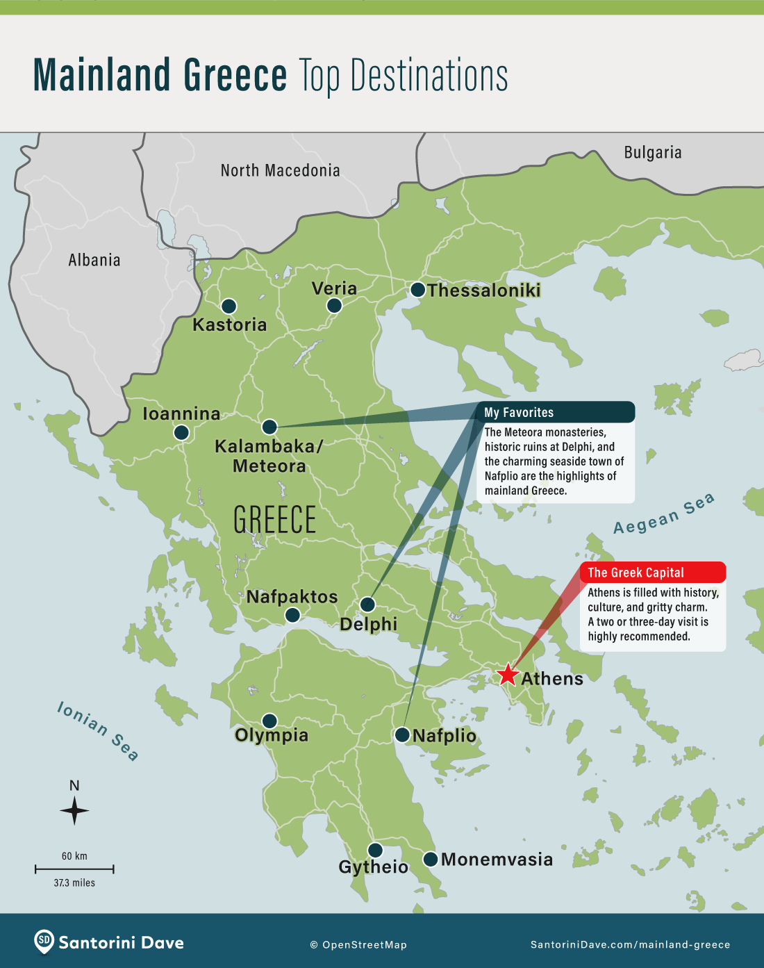
While the islands get the fame, the mainland holds Greece’s most significant ancient sites (Delphi, Olympia, Meteora). A road trip here is often easier and cheaper than an island-hopping itinerary because you aren’t at the mercy of ferry schedules or high winds.- 4. Use “Open-Jaw” Flights to Save Time
To avoid backtracking to Athens, book a “multicity” ticket. Fly into Athens and out of an island (like Santorini, Mykonos, Crete, or Rhodes), or vice versa. Many major European hubs (London, Paris, Frankfurt) fly direct to these islands during the tourist season (May to October).- 5. Distances on the Map Can Be Deceptive
Greece is mountainous and ferry routes are rarely direct. A “short” drive on the mainland (or Crete) often involves slow, winding roads. Similarly, neighboring islands may require a long, indirect ferry connection. Always measure your trip by travel time, not physical distance.


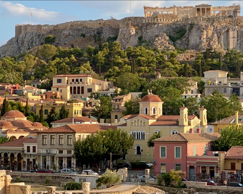
Athens is the capital and largest city in Greece. The iconic Acropolis is a must-see attraction in the center of the modern city.
Map of Mainland Greece
The Meteora monasteries near the town of Kalambaka in Central Greece.

Map of Greek Islands
Santorini is the most popular of all the Greek Islands and one of the most romantic destinations in Europe.

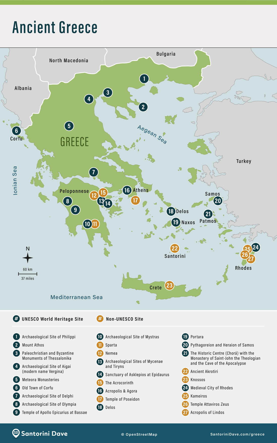
Map of Ancient Greece & City States
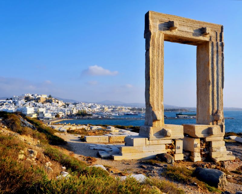
The Portara Gate on the delightful island of Naxos.
Greece – When To Go
Mykonos and the Greek islands are at their best from late May until early October.

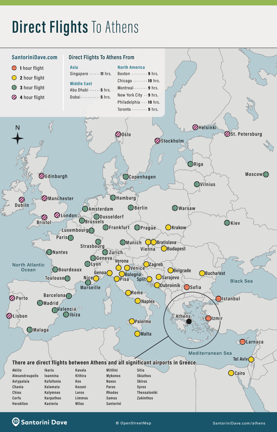
Flights to Athens
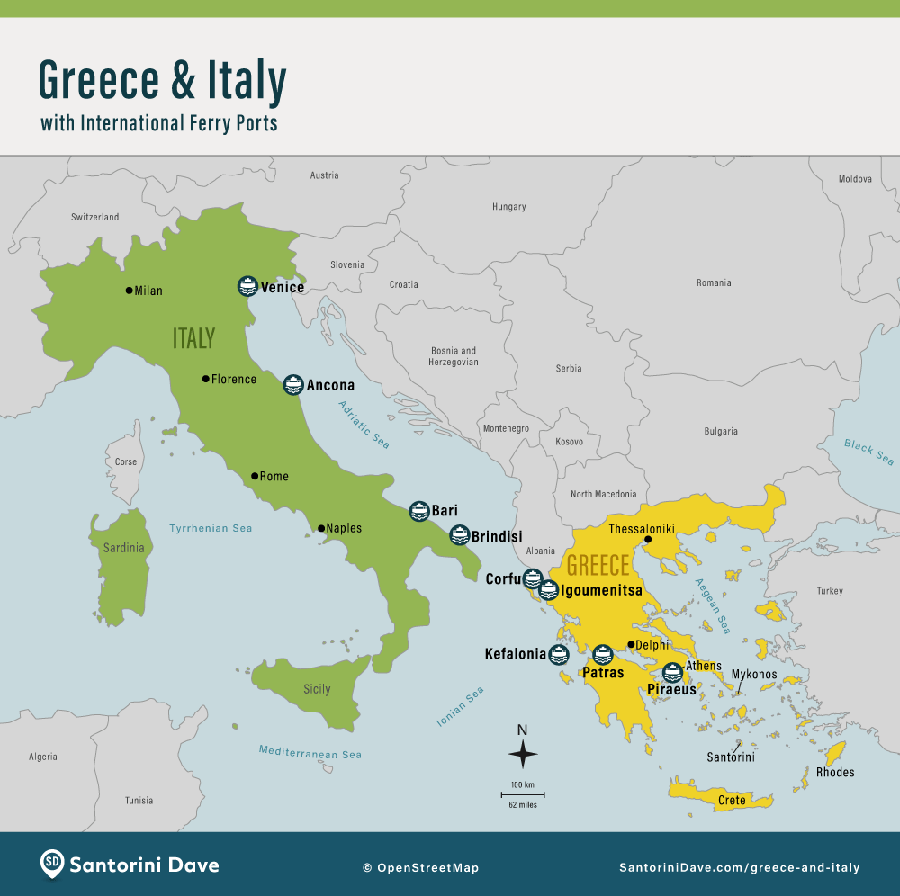
Map of Greece & Italy
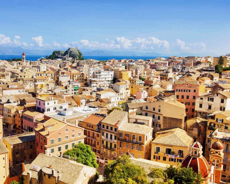
Corfu Town on the island of Corfu has a definite Italian feel owing to its years under Venetian rule.

About Santorini Dave