Greece › Santorini › Maps
Updated: August 11, 2026 • By Santorini Dave
Questions? dave@santorinidave.com
See Also
- Where to Stay in Santorini
- Best Hotels in Santorini
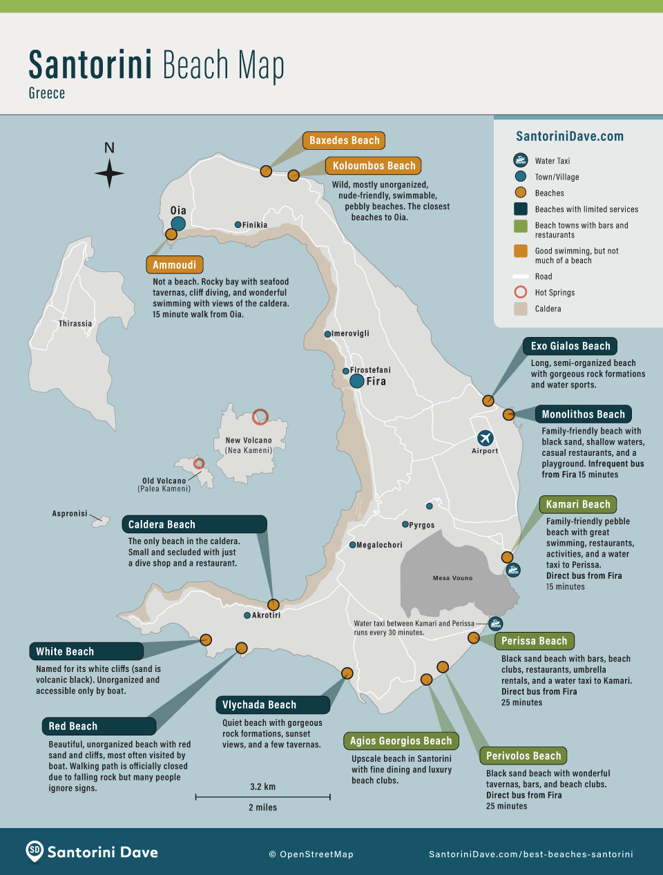
- Best Beaches in Santorini
- Best Things to Do in Santorini
- Santorini Buses
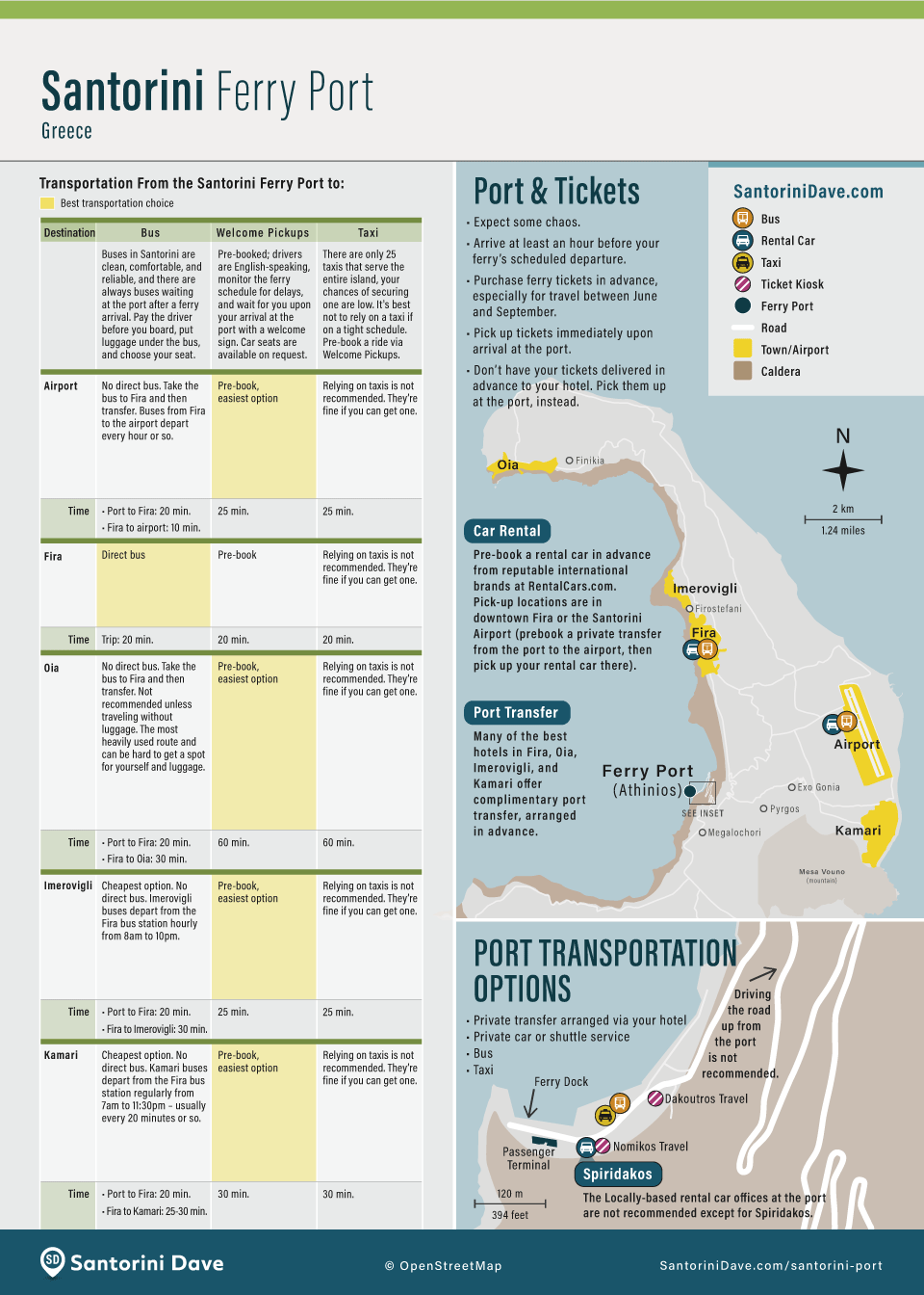
- Santorini Ferry Port
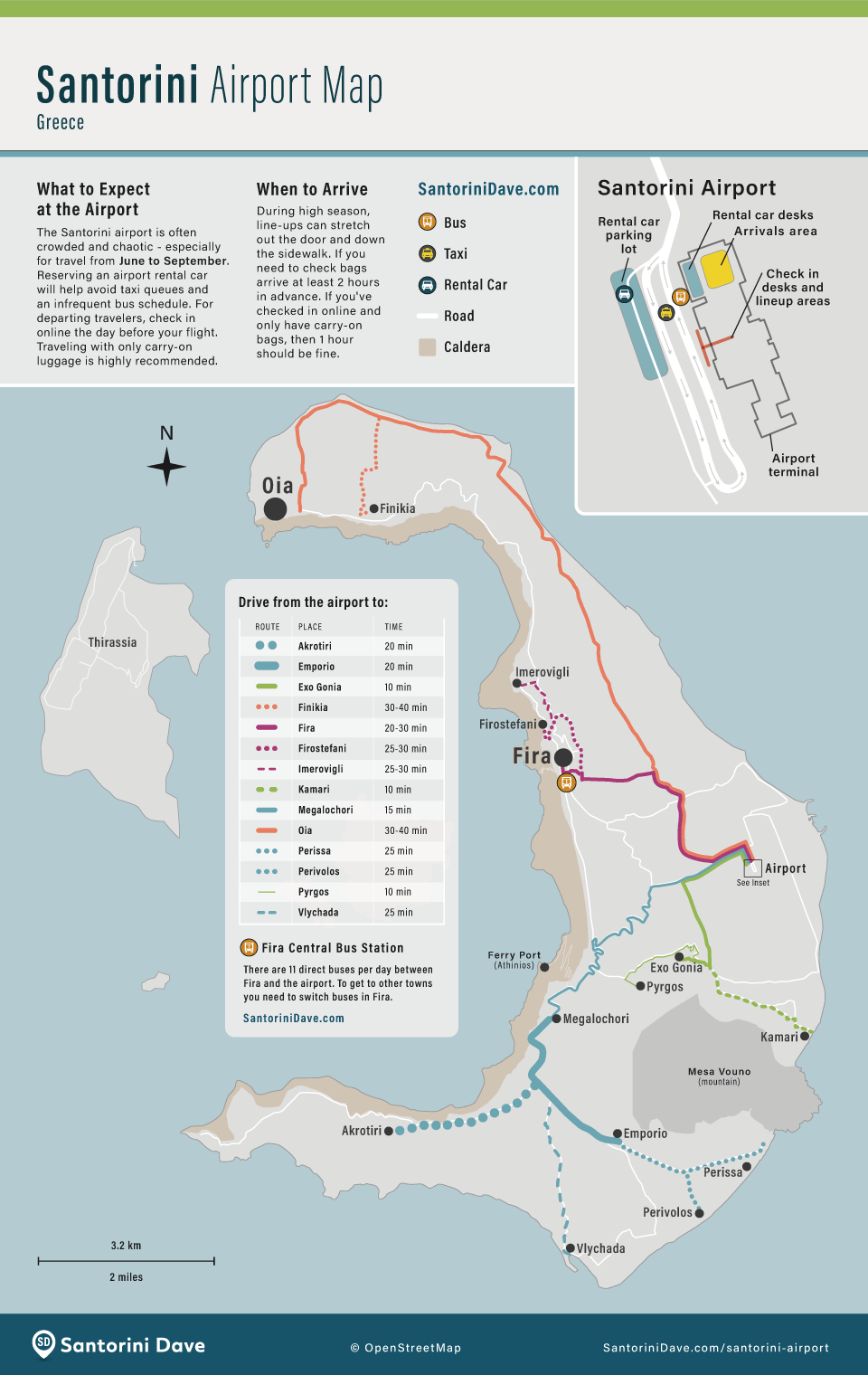
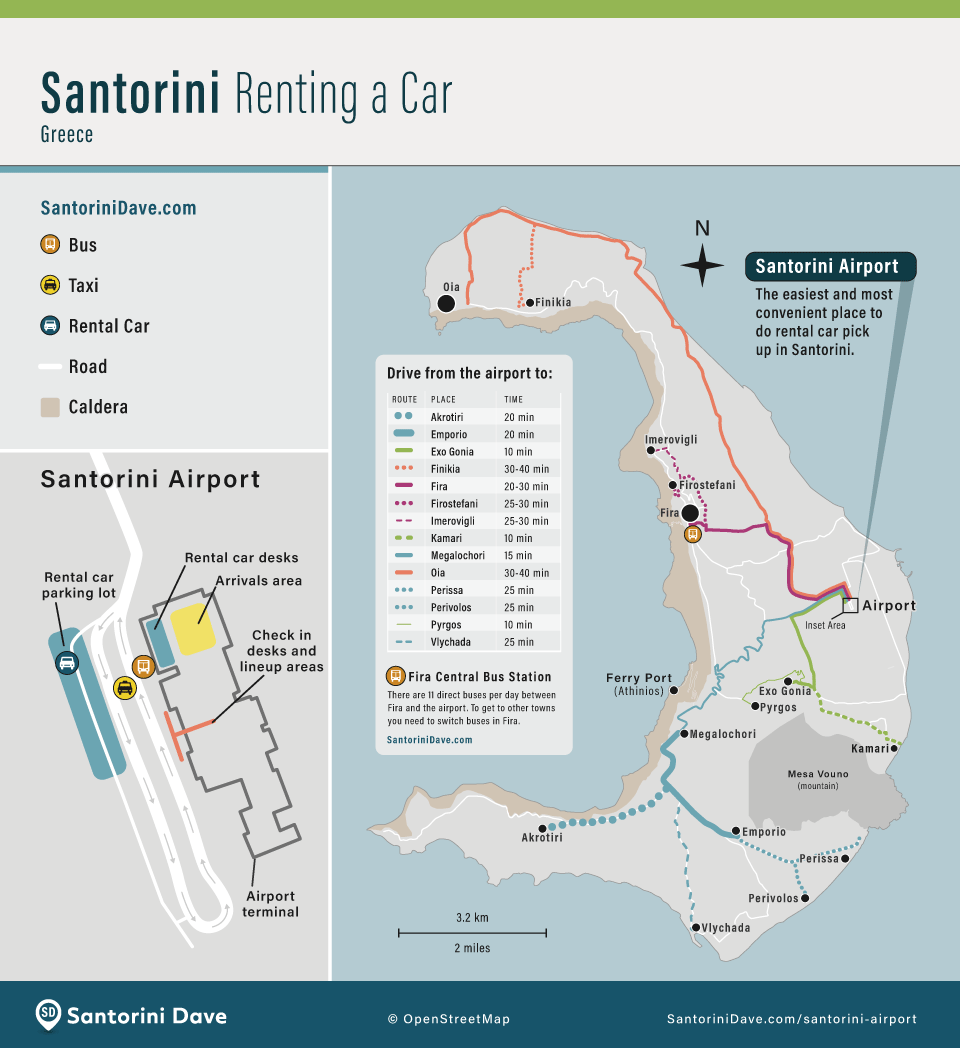
- Santorini Airport
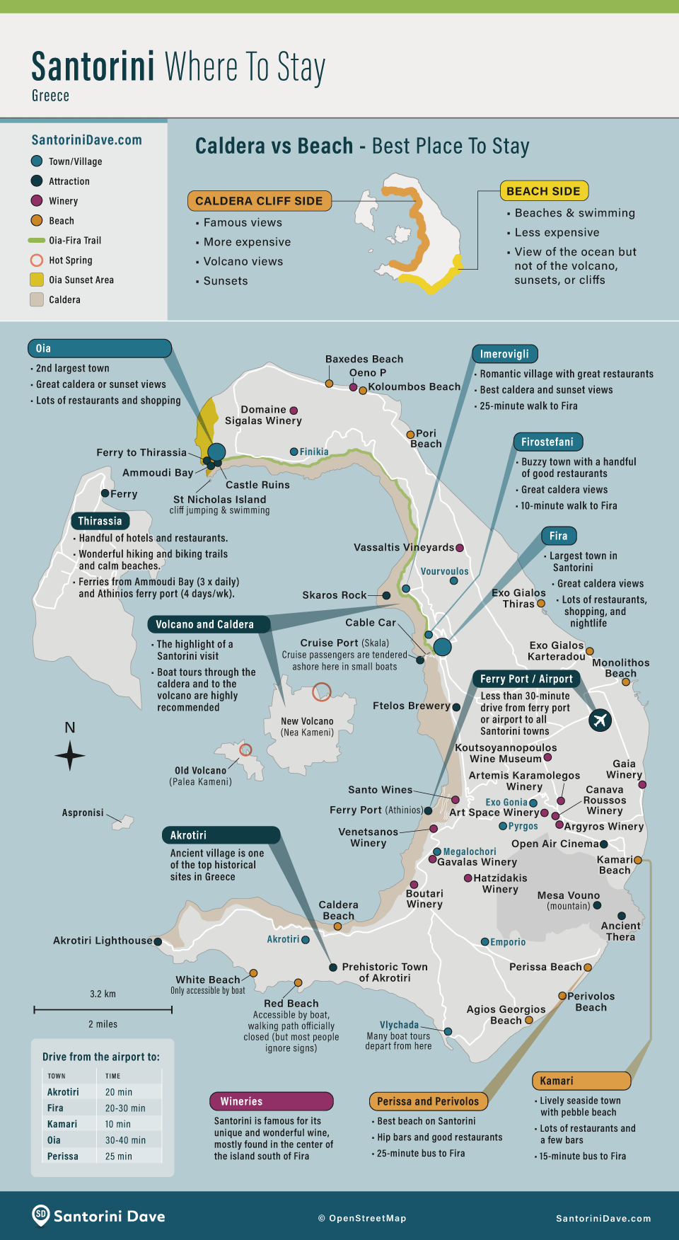
Santorini is a long, narrow island wrapped around the caldera. Oia is at the northern end; Fira, Firostefani, and Imerovigli line the central caldera cliffs; Akrotiri is in the southwest; and the main beach towns of Kamari, Perissa, and Perivolos are on the flatter east and southeast coasts. Santorini Airport is east of Fira, while the ferry port sits below the caldera cliffs southwest of Fira.
Santorini Maps: My Tips
- Download Santorini for offline use in Google Maps. Also save your hotel, the Fira bus station, airport, and ferry port before you arrive. It makes navigation much easier when reception is weak or you are trying to find a hotel hidden among the caldera lanes.
- Maps don’t show Santorini’s vertical distances very well. Two places that look next door on a map can be separated by steep lanes or dozens (or hundreds) of stairs, especially in Oia, Imerovigli, Firostefani, and Fira. This matters when choosing a hotel or traveling with luggage or limited mobility.
- Fira is the bus hub. Santorini’s public buses operate on a hub-and-spoke system centered on Fira. For trips such as Oia to Akrotiri or Kamari to Oia, you travel through Fira and change buses.
- The airport and ferry port are on different sides of the island. Santorini Airport is east of Fira on relatively flat roads. Athinios Ferry Port is below the caldera on the southwest side and reached by a steep switchback road that becomes congested around ferry arrivals and departures.

Where to Stay in Santorini
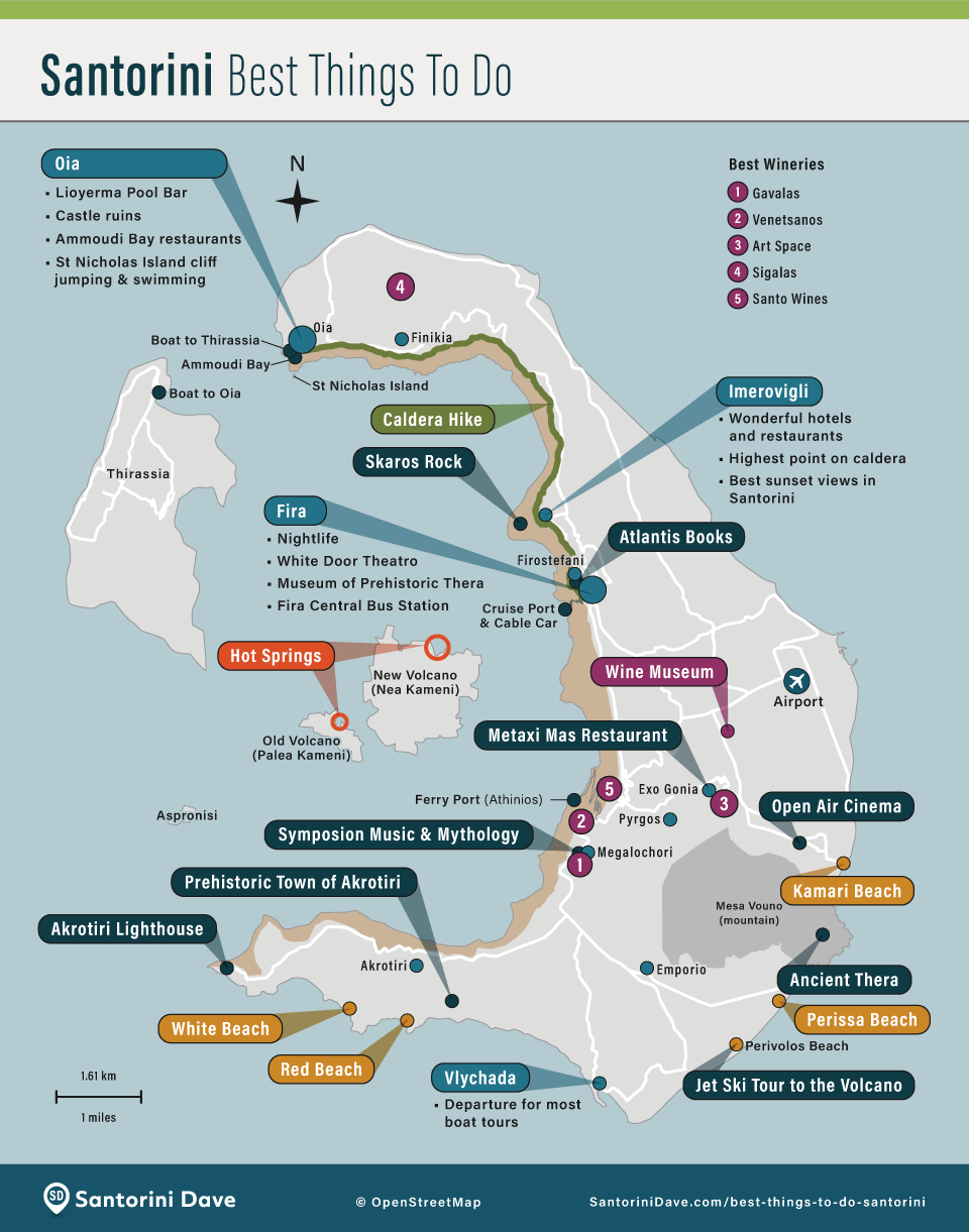
Santorini Attractions & Things to Do
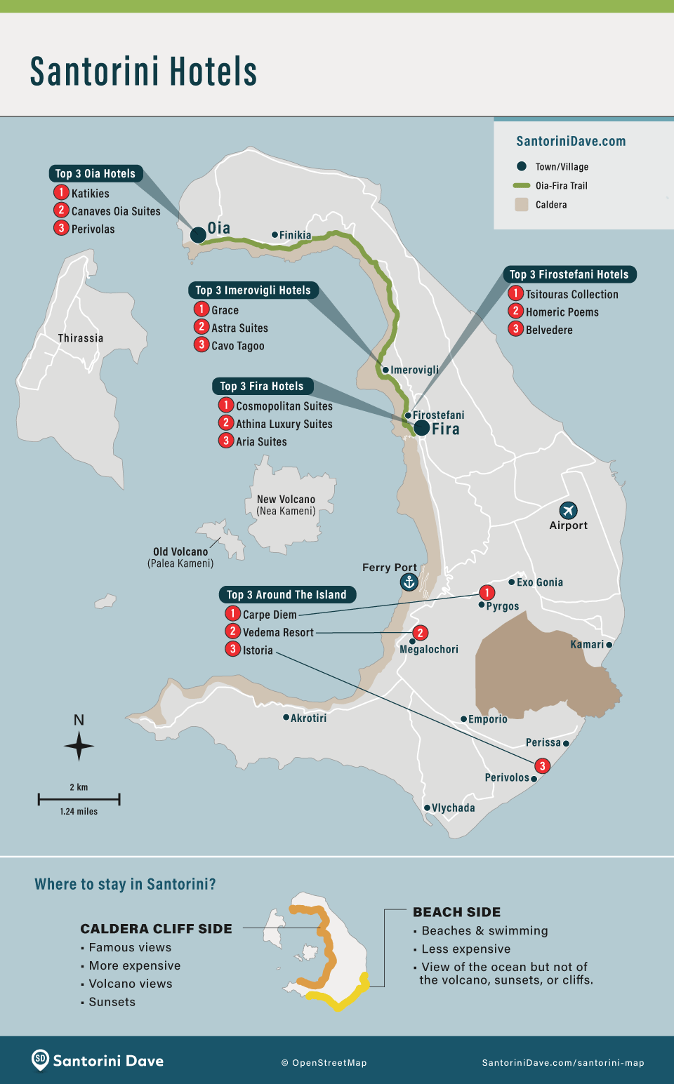
Santorini Hotels
Santorini Towns and Villages
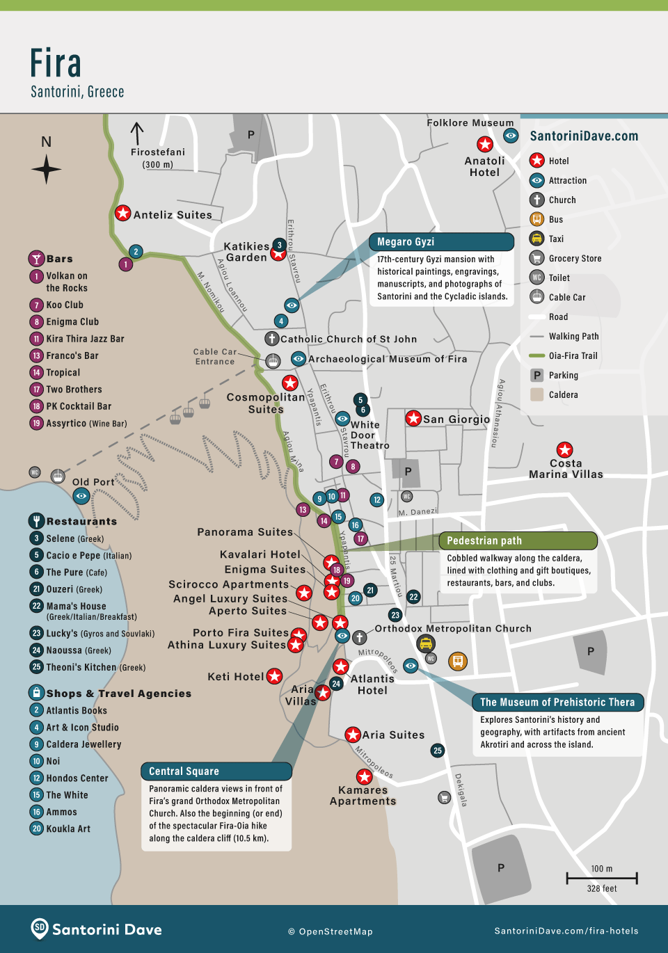
Map of Fira
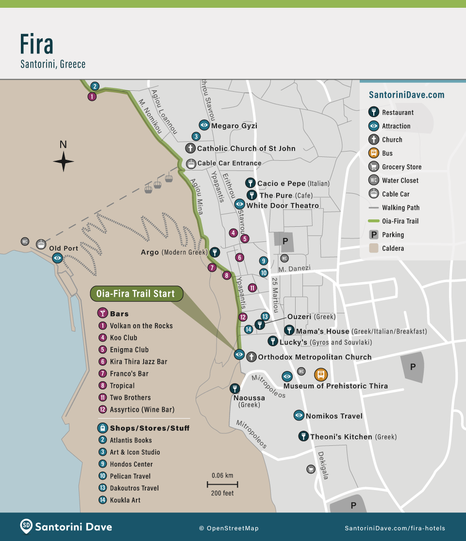
Map of Fira’s Best Hotels
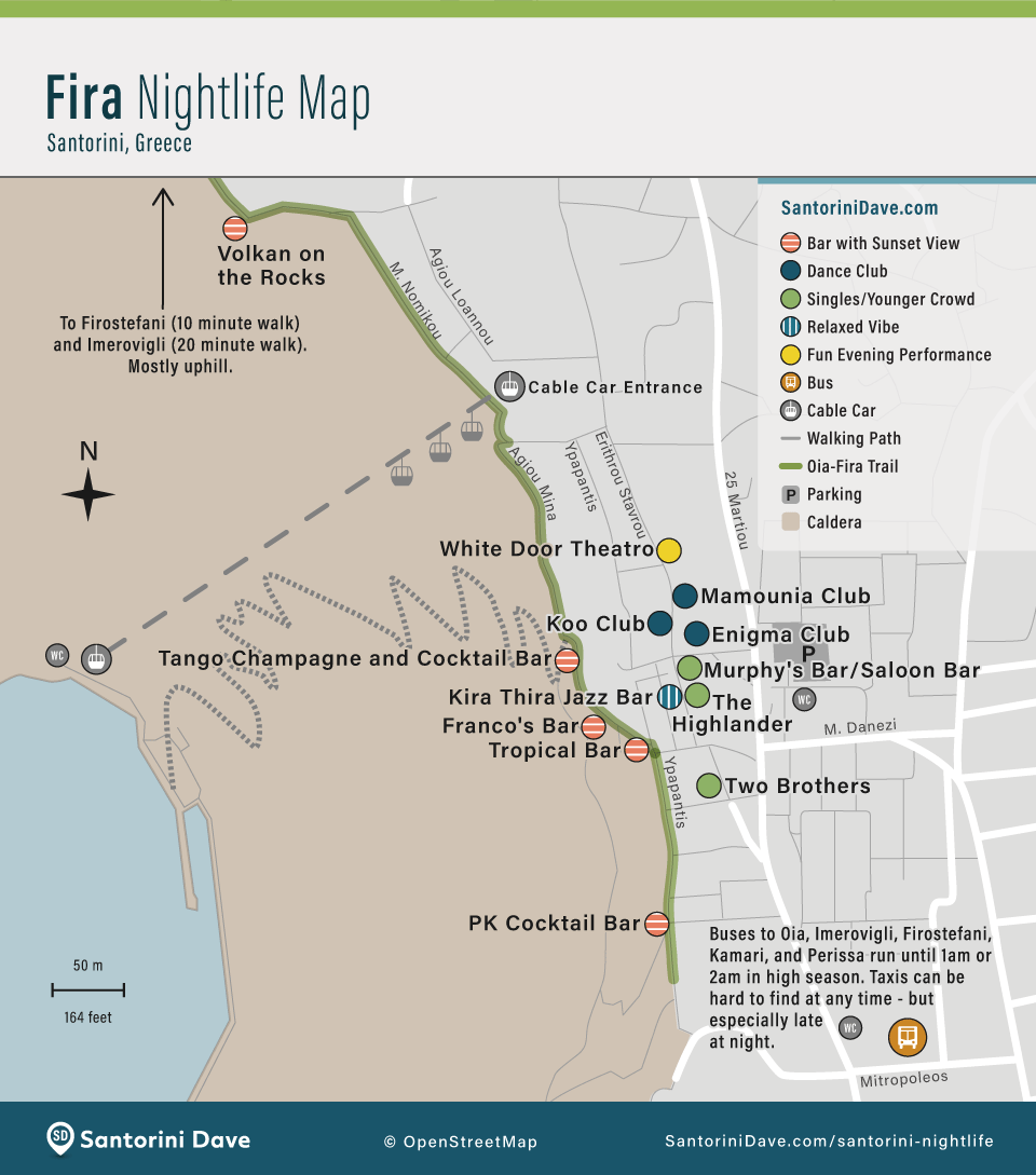
Map of Fira’s Best Bars and Clubs
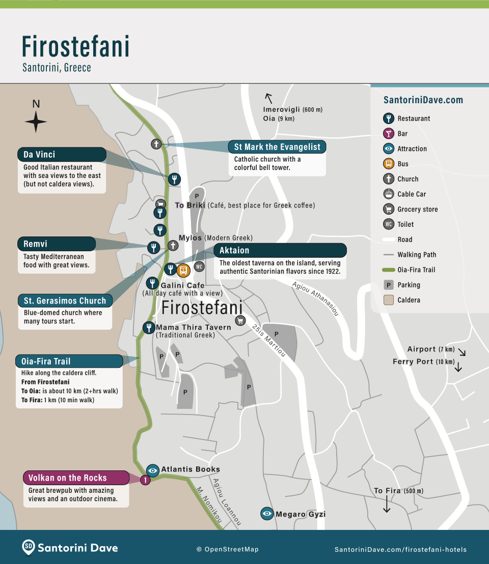
Map of Firostefani
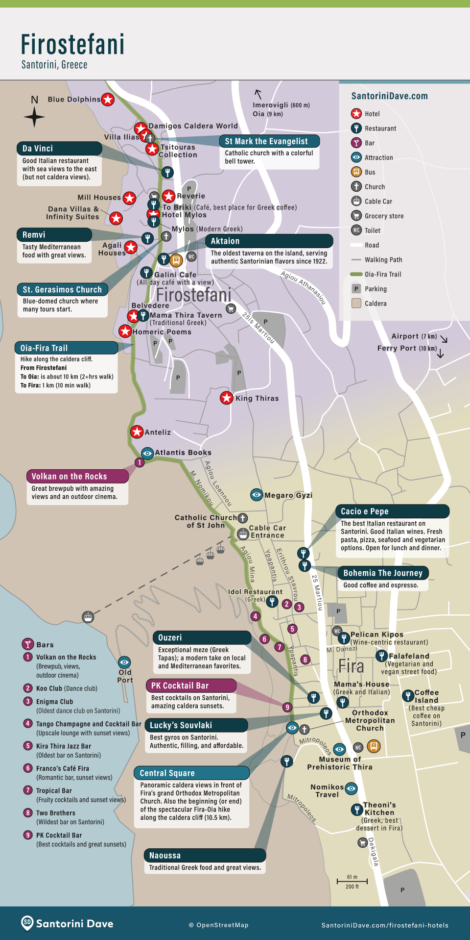
Map of Firostefani’s Best Hotels
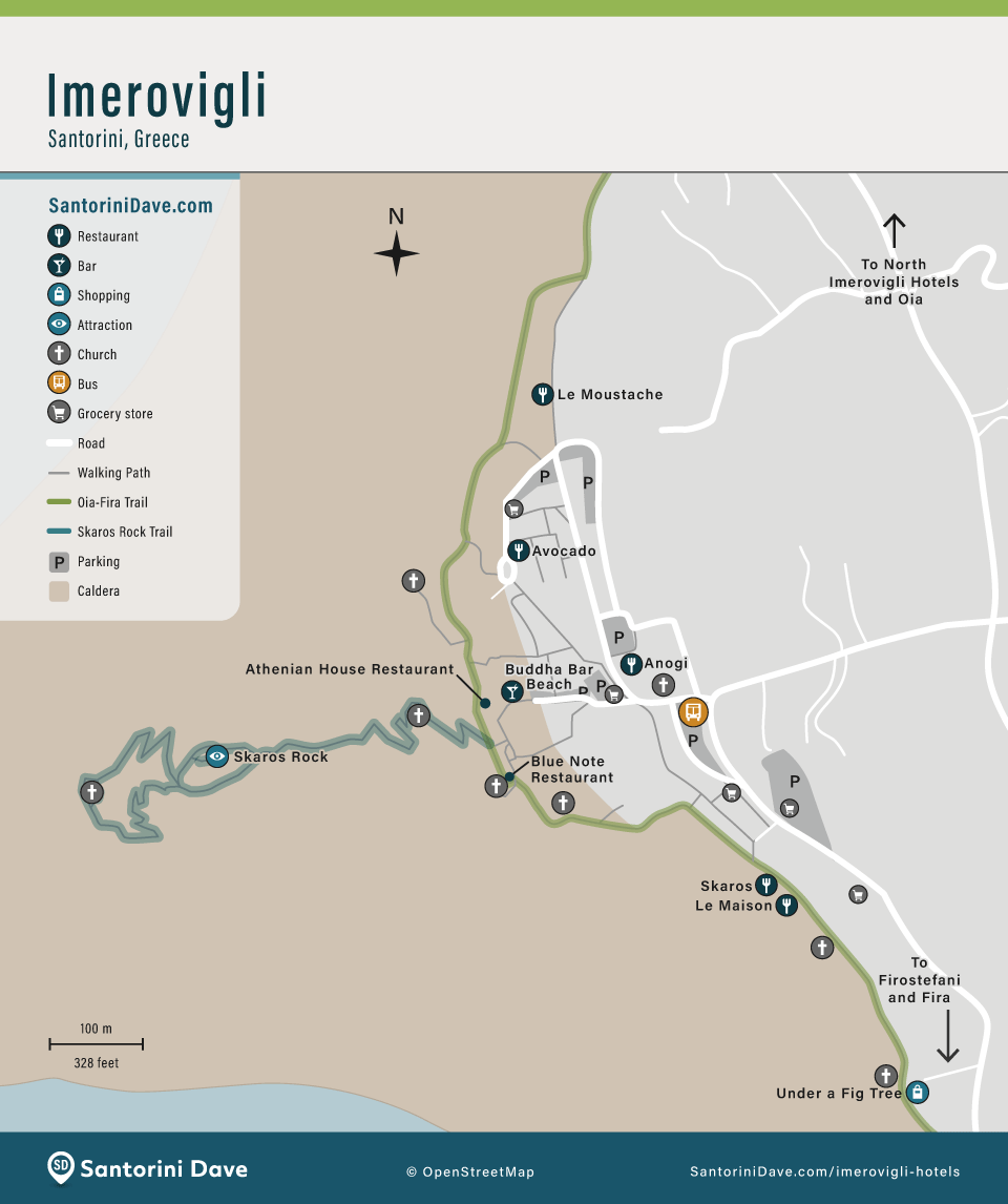
Map of Imerovigli
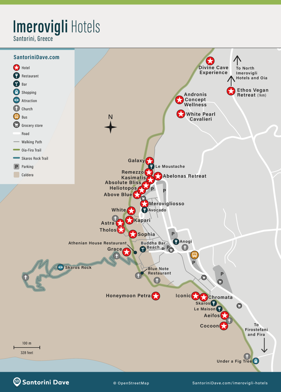
Map of Imerovigli’s Best Hotels
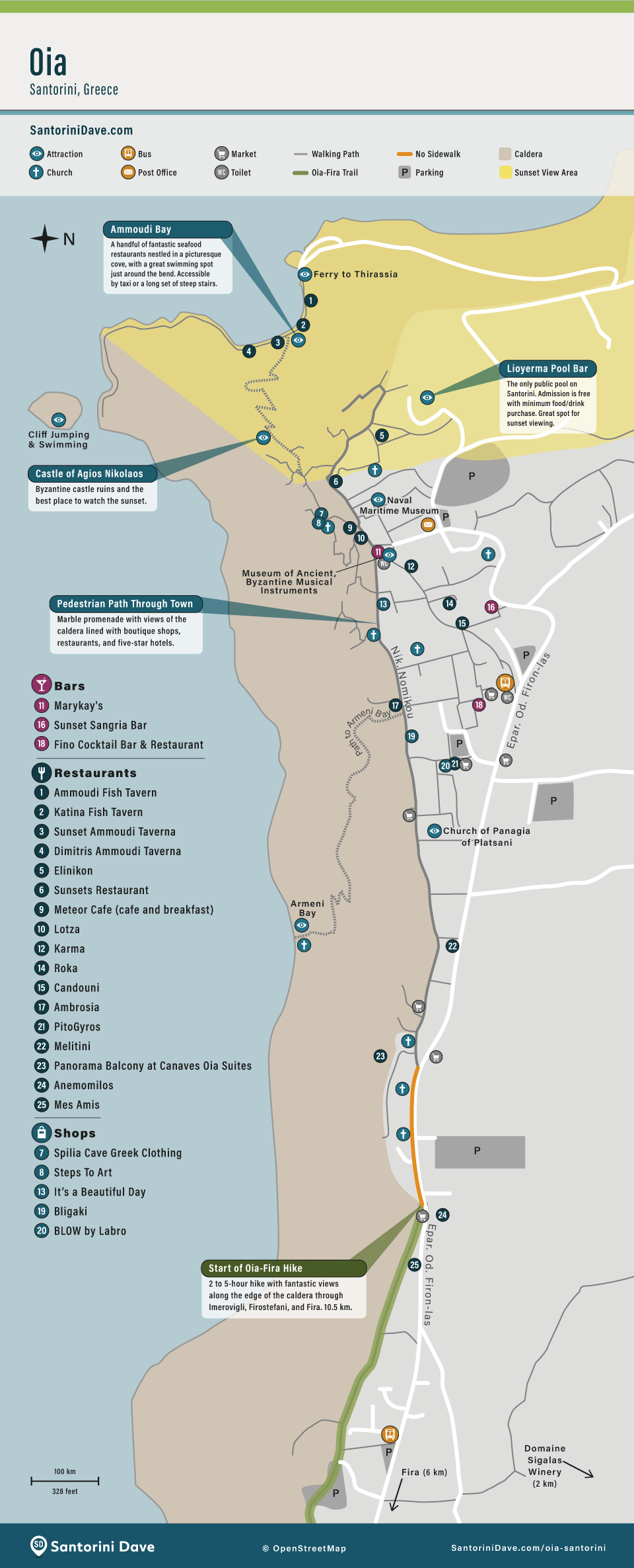
Map of Oia
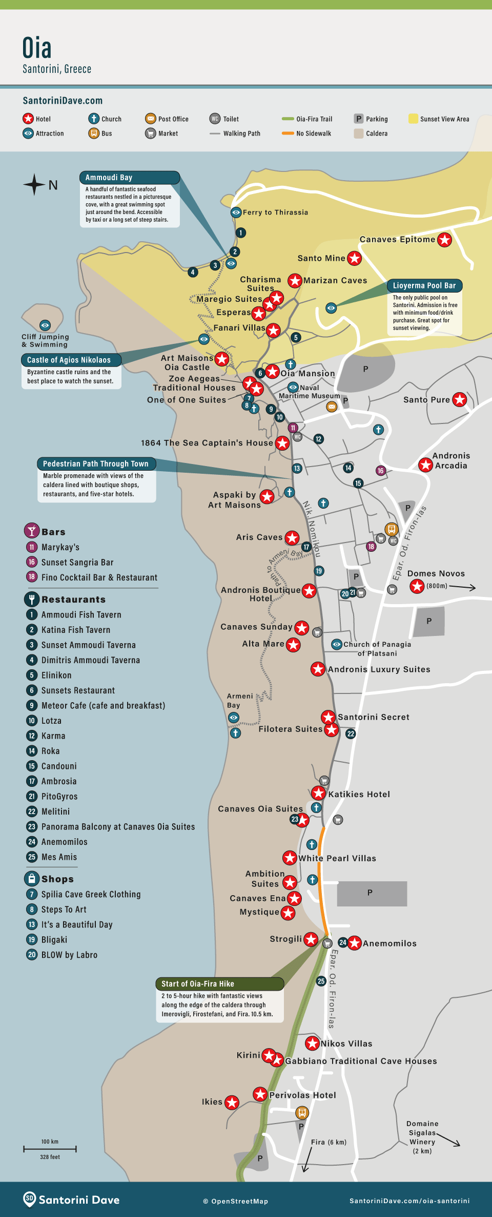
Map of Oia’s Best Hotels
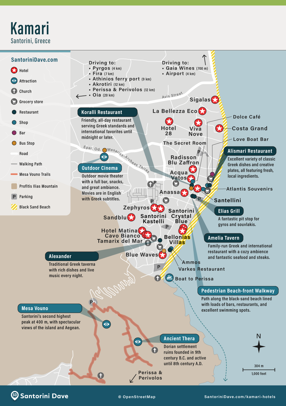
Map of Kamari
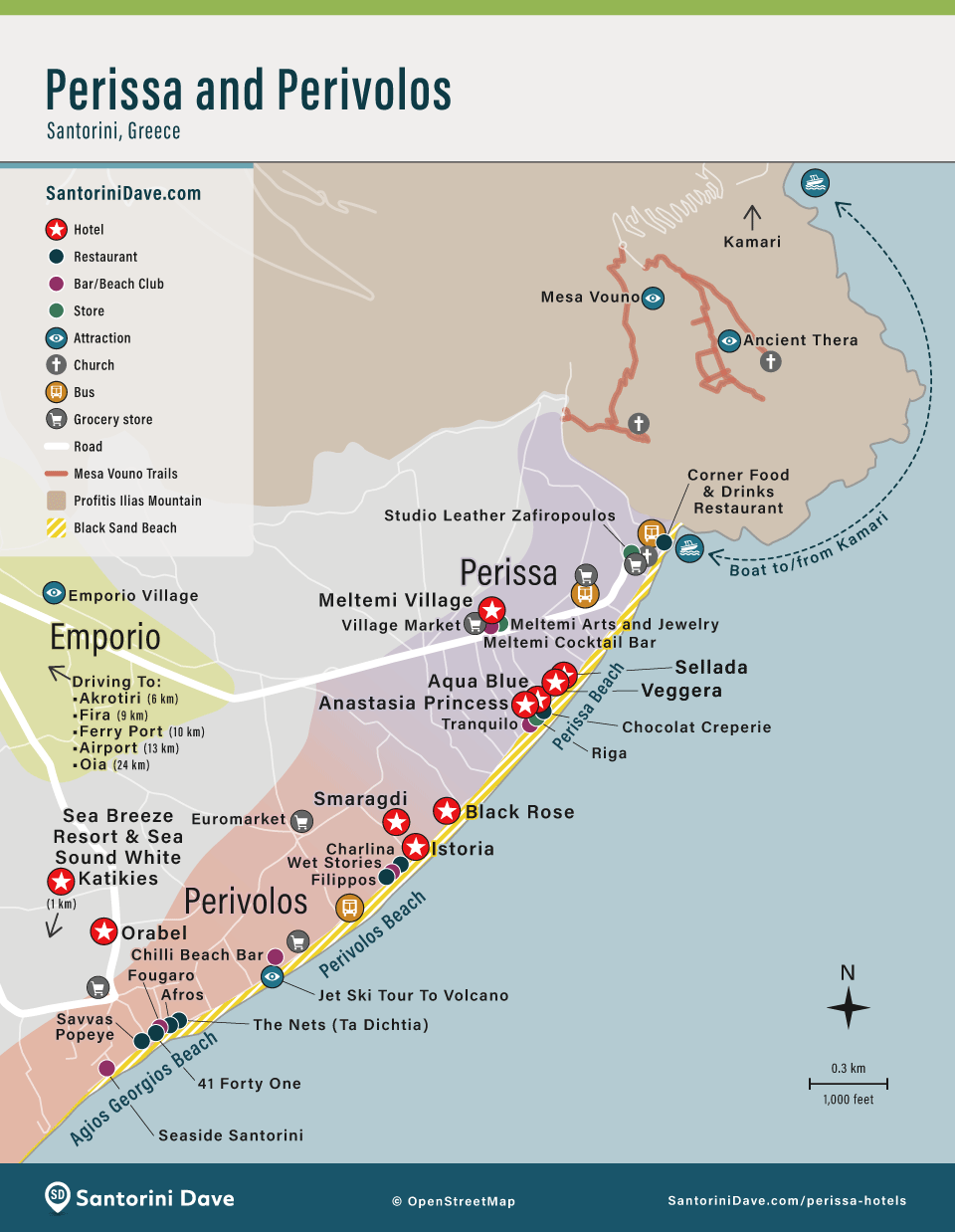
Map of Perissa and Perivolos
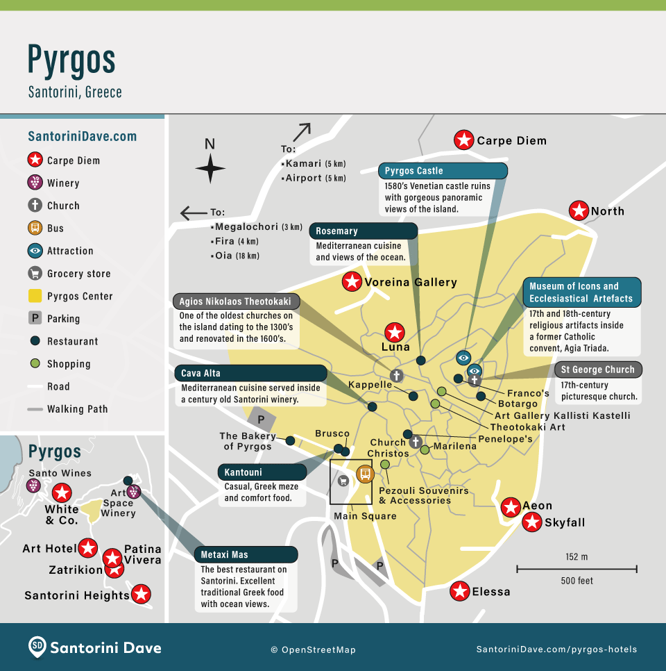
Map of Pyrgos
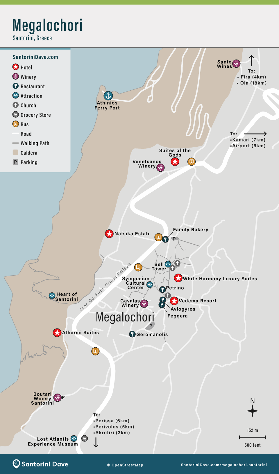
Map of Megalochori
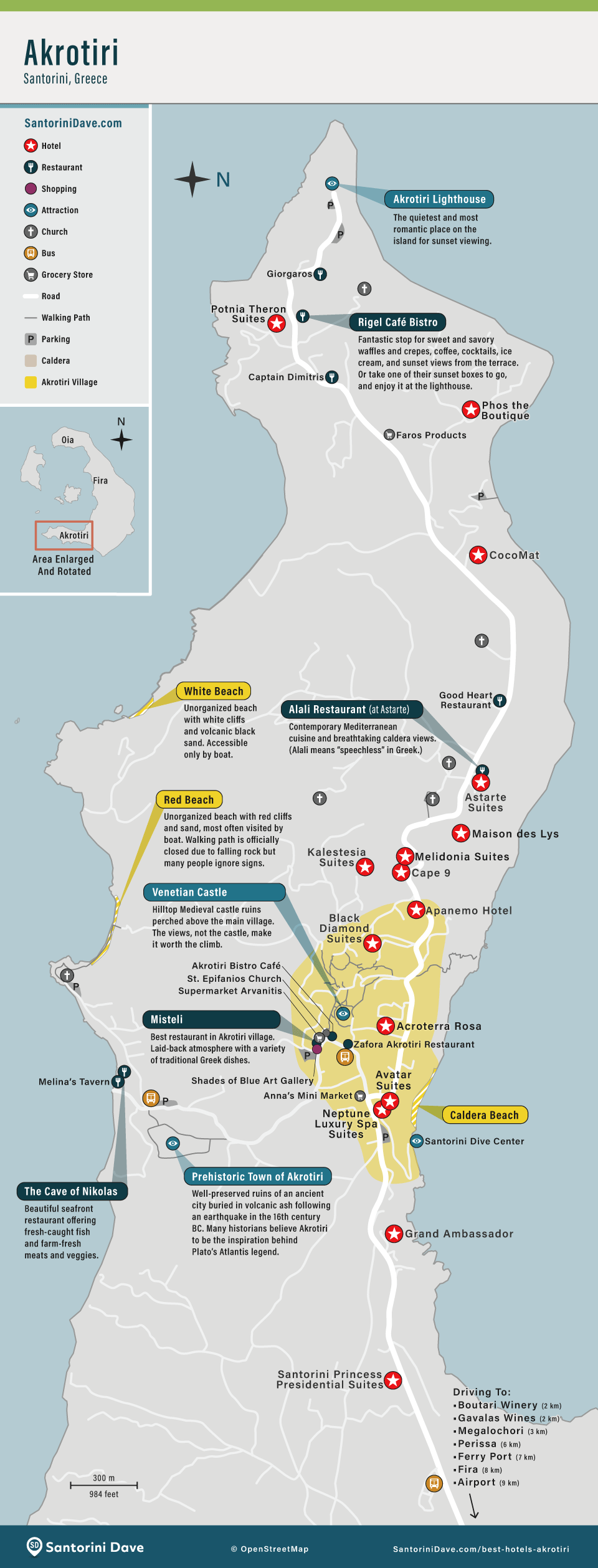
Map of Akrotiri
Getting To and Around Santorini
How to Get to Santorini
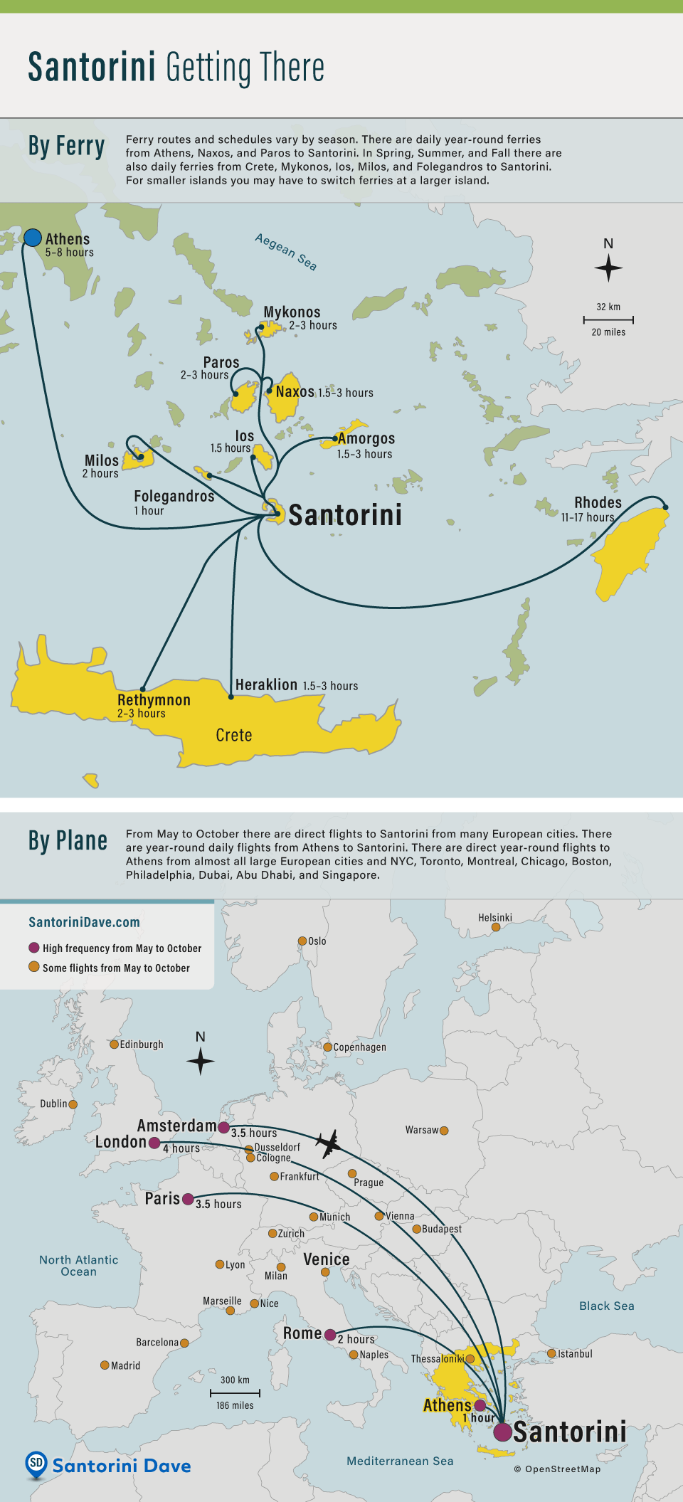
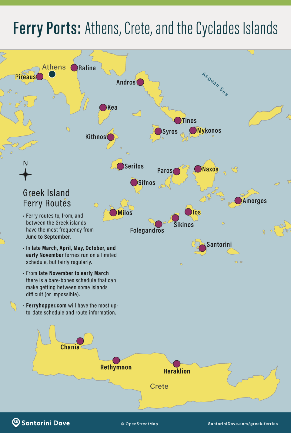
Greek Island Ferry Ports around Santorini
Santorini Airport Map
Santorini Ferry Port Map
Santorini Car Rental Map
Santorini’s public buses are centered on Fira, with routes to Oia, the airport, ferry port, Kamari, Perissa, Akrotiri, and other major stops. See my Santorini Bus Guide for routes, fares, and schedules.
Santorini Attractions and Activities
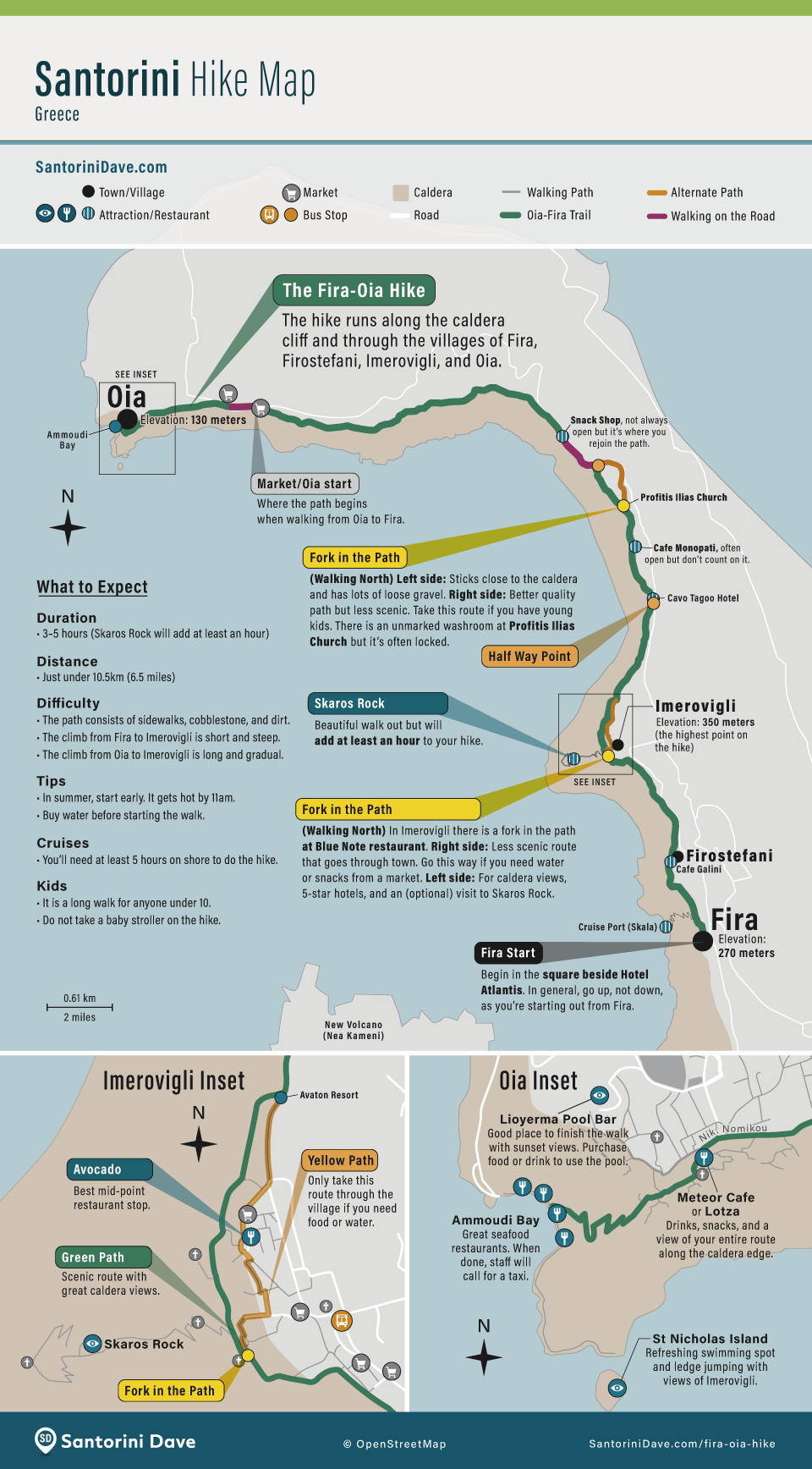
Fira to Oia Hiking Map
Santorini Beaches Map
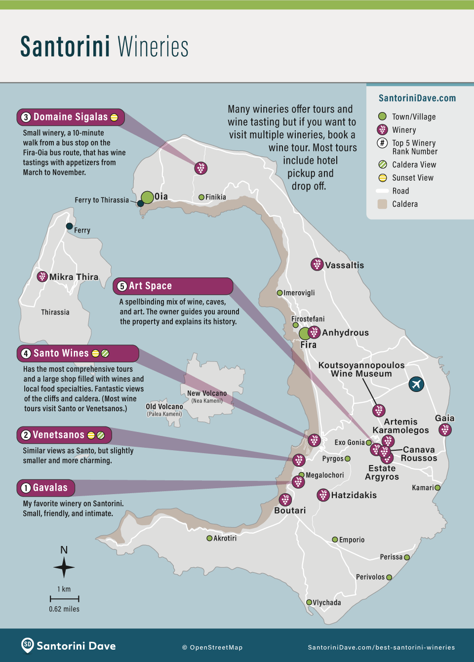
Santorini Wineries Map
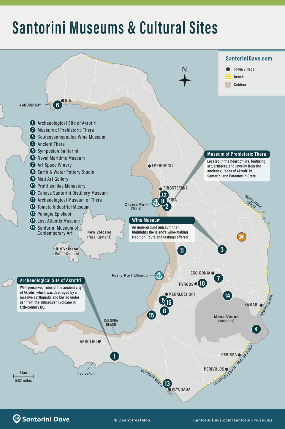
Santorini Museums and Cultural Sites Map
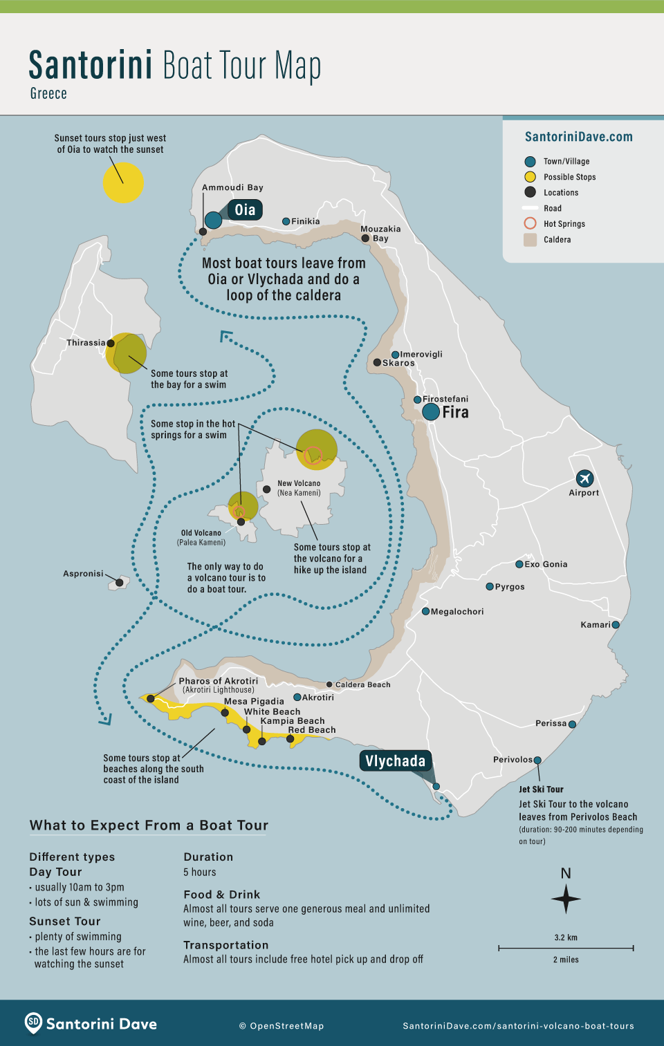
Santorini Boat Tours Map
Santorini Geography
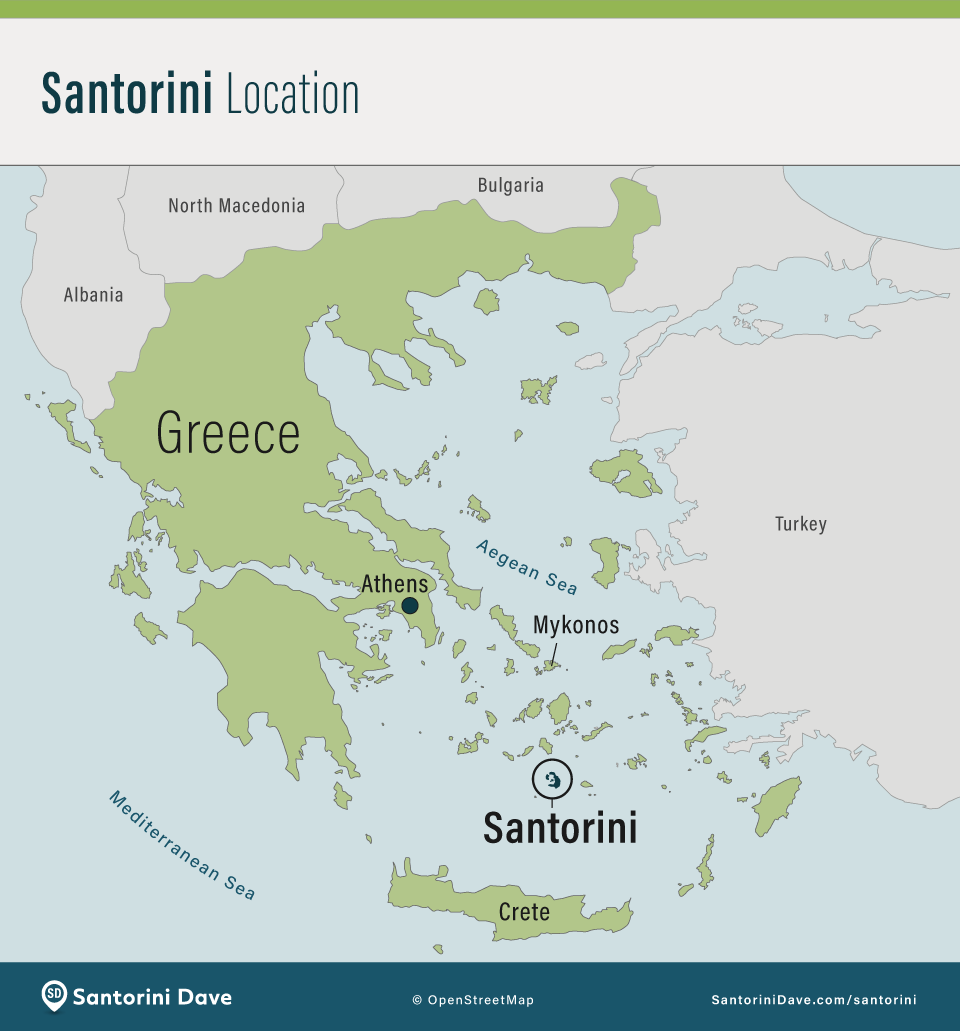
Where is Santorini?
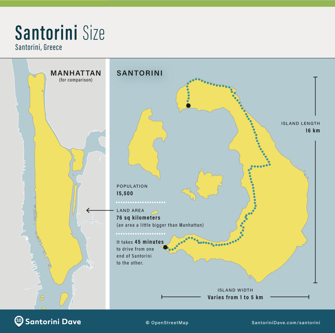
How Big is Santorini?
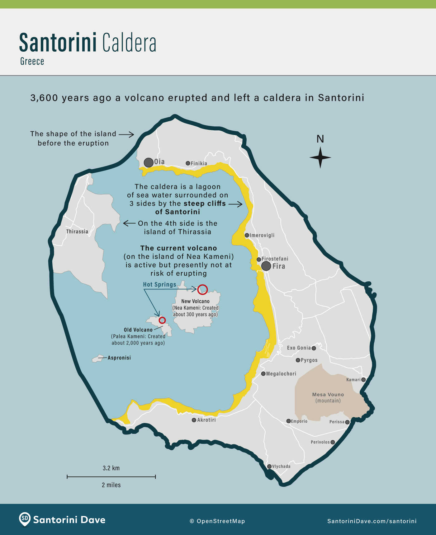
How Santorini’s Caldera Was Formed

About Santorini Dave